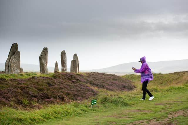
Holidaymakers urged to share snaps of Ring of Brodgar to help protect ancient stone circle
The Ring of Brodgar, one of the largest stone circles in Britain, was built around 4,000 years ago and served as a massive ceremonial site that may have drawn people far and wide during the Neolithic period.

Today, the site is ever increasingly fragile, with the low-lying position between two lochs causing problems with drainage and erosion caused by extreme weather and rising water levels linked to climate change.
Advertisement
Hide AdAdvertisement
Hide AdHistoric Environment Scotland has long managed visitor impact to the site by introducing a one-way system and alternating routes around the circle, but said photographs taken by visitors could now help gauge day-to-day changes at the ancient site.
A similar and successful approach has been taken at sites including Machrie Moor standing stones on Arran and Clava Cairns near Inverness as part of the Monument Monitor project.
Adam Frost, Senior Digital Documentation Officer at HES, said: “Since launching in 2018, the Monument Monitor project has been a really useful tool for conservation work across the sites we care for. Using pictures sent to us by visitors, we’ve been able to model how climate change will affect flooding at Machrie Moor Standing Stone Circle in Arran, as well as measure the impact of increased visitor footfall at Clava Cairns.

“At Ring of Brodgar we’re monitoring the effects of climate change, and we want to capture images that record how well the site can drain after increasing incidences of extreme weather. We hope that visitors to the site over the summer will be inspired to get involved in the care of this unique monument and send us their snaps.”
The Ring of Brodgar is one of the landmarks that make up the UNESCO Heart of Neolithic Orkney World Heritage Site, with the Skara Brae settlement, the Maeshowe Chambered Cairn and the Stones of Stenness among the other ancient sites in the remarkable landscape that tells a powerful story of life in Orkney from 5,000 years ago.
The stone circle, a later site built around 2500 BC and 2000 BC, was originally made up of 60 stones, with 36 standing today. Some are lost and some are represented by stumps and packing stones. One stone carries a Norse runic inscription, and at least one other has been struck by lightning.
The site holds at least 13 prehistoric burial mounds and features a large rock-cut ditch which surrounds the circle.

Monument Monitor was originally a collaborative research project between HES and the Institute of Sustainable Heritage at University College London, run by Rosie Brigham for her PhD research, and has now been extended.
Advertisement
Hide AdAdvertisement
Hide AdThe project has also run at Drumtroddan Standing Stones near Mochrum in Dumfries and Galloway and the Ness of Burgi in Shetland, among others.
HES said the ‘citizen science’ project connected historic sites with volunteers and communities and was a valuable way to assess impacts of erosion, water damage, vandalism or littering, particularly at more remote landmarks across the country.
Comments
Want to join the conversation? Please or to comment on this article.