

The latest plans set out more detail of changes in six of the nine local areas of Edinburgh which the city council is focusing on.
The measures are set to be implemented under powers delegated to officials but “key stakeholders” in each area, including councillors, community councils and business representatives are given five days to comment.
Here are some maps and captions detailing some of the changes the Capital will see as the city becomes more catered to social distance living.
Here are some maps and captions detailing some of the changes the Capital will see as the city becomes more catered to social distance living.
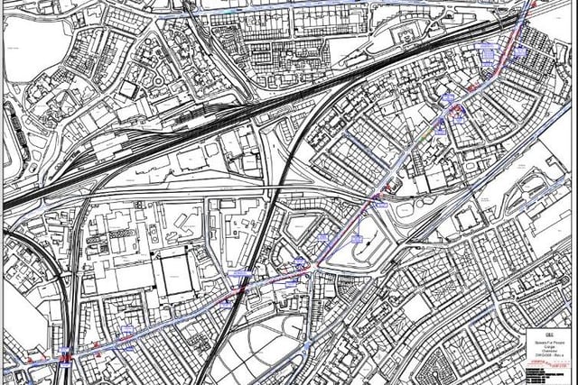
5. Gorgie/Dalry
Widened footways under the railway bridge at Robertson Avenue. Relocated south side bus stop. Extended footway on north side between Smithfield St and Wheatfield St, with the loading bay relocated eastwards. Increased footway width around the railway bridge at McLeod St. Widened footway on the south side between Ardmillan Terrace and Gorgie City Farm. Additional footway space at the Gorgie Road/ Dalry Road junction. Widened footway adjacent to Dalry Cemetery. Relocation of loading bay to widen footway on south side between Orwell Place and Orwell Terrace and widened footways on both sides of the road from Dalry Gait to Haymarket with loading provision retained. Photo: Supplied
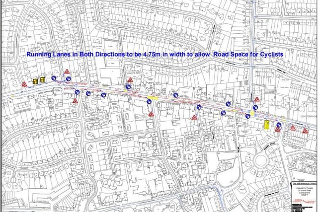
6. Corstophine
Retain many parking and servicing bays on St Johns Road. Widen footpaths on both sides of St Johns Road where pavements are very narrow and all bus stops remain. Widening of footway on north side from Templeland Road to Victor Park Terrace, and on south side from opposite Templeland Road to Farmer’s Autocare, some loading bays retained. Widening of narrow sections of footway on both sides between St Ninian’s Road and Station Road, 4.75m width running lane in either direction to provide additional space for cyclists. Photo: Supplied