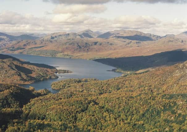
Walk of the Week: Aberfoyle to Callander


Appropriately, our intended trav-erse of the Menteith Hills, a range of hills on the Highland Boundary Fault, follows part of the Rob Roy Way. Waymarked with yellow arrowheads within small green circles, it would be difficult to get lost and, with a south-westerly wind at our back, the return of rain by the time we were descending to Loch Venachar and Callander would hopefully be of little concern.
Nevertheless, given that forecast, we opted for the 7-mile traverse to the East Lodge car park by Loch Venachar, and a pre-placed car, rather than continuing a further 3 miles by minor road to Callander.
Advertisement
Hide AdThe entire route is within the Loch Lomond & The Trossachs National Park. The loch side area, and the curiously named Loch Drunkie, had previously been explored with Jimbo and we had noted a green sign at the East Lodge car park – footpath to Aberfoyle via Menteith Hills, a route immediately added to my list of walks to do.
The Route
From the very large car park, once the site of Aberfoyle’s railway station, head east on the pavement by the A821 to the signposted Tarmac drive that leads to the Dounans Outdoor Centre. As an alternative, that point can also be reached by following a short section of the old railway line, now part of National Cycle Route 7 from Glasgow to Inverness.
Pass the centre on the left, and then turn right on a gravel track that heads by the top end of Aberfoyle golf course. With steep slopes on the left and the golf course to the right, the track rises to give lovely open views over Flanders Moss. Continue to a signposted T-junction. From the right is the approach from Braeval car park.
Turn left on the gently rising track to reach a new gate and a sign – ‘Malling Forestry Estate, please prevent fires.’ No chance on our sodden day! The very new track quickly comes to an end, but on its left is the mapped path of old. Cross a burn to enter a lovely area with trees on the right and an escarpment on the left. Unsurprisingly after days of rain, the path was exceedingly muddy in places and it was amusing to meet two mud-bespattered mountain bikers, constantly coming off but obviously enjoying themselves.
Eventually clear the forest by a new gate (put dogs on lead) and traverse the open moorland, heading north-east. Midway through the open area cross one burn, quite substantial on our day. Exit the moorland by another new gate by a dyke, from where a short rise leads to the high point of the traverse, followed by a slight descent to the narrow, secluded and charming Lochan Allt a’Chip Dhuibh, not named on my map.
The loch side path leads to a forestry track. At this point a small path climbs to a nearby mound with a picnic table, giving views to Ben Ledi and the north. Continue by track to the north end of the loch, cross its outflow by a causeway dam and pass a padlocked boathouse on the right. The track slants down north-east, later through a large cleared area giving the first views of Loch Venachar, and so to the East Lodge car park; a rewarding walk with a few hours grabbed from a very wet day. If continuing by foot, allow another hour to reach Callander.
Map Ordnance Survey map 57, Stirling & The Trossachs
Distance 7 or 10 miles
Height 250m
Terrain Track, path and minor road
Start point Aberfoyle large car park
Time 3 or 4 hours
Nearest towns Aberfoyle and Callander
Refreshment spot The Harbour Café, north shore Loch Venachar