The 'drink maps' that plotted Scotland's deep thirst for alcohol
A rare set of maps that depicts Victorian Scotland’s taste for the drink – and the beer houses, boozers and bottleshops that were open for business to meet the seemingly unquenchable thirst of the country – has emerged.
Street-by-street the businesses were plotted in cities across the country, with the bars and shops typically intensifying around docks and city centres as the industrial revolution boomed. They were also found, albeit more sparingly, in more affluent neighbourhoods where the rich had the space and luxury to drink indoors.
Advertisement
Hide AdAdvertisement
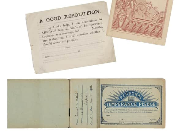
Hide AdPrinted by the temperance movement, which found an early home in Scotland, the maps were used as a propaganda tool to both convert people to abstinence and win over magistrates and lawmakers charged with trying to regulate businesses that heaved with custom amid the grind of overcrowded homes and working life. Concern over the ‘drink question’ spiked not only in Scotland and the rest of the UK, but across the western world amid the mass consumption of alcohol.

The first ‘drink map’ was printed in Manchester in 1840, with temperance campaigners in Glasgow, Edinburgh and Aberdeen printing their own documents – each printed up to 5,000 times – in the years that followed.

Kris Butler, of Boston, Massachusetts, lawyer and author of Drink Maps of Victorian Britain, said: “The book is the story of drink maps and it is probably not what you think.
"It’s not about pub crawls or plotted ale trails. Instead, these are maps with an agenda that was adamantly hostile to drinking alcohol. The logic at the time of the maps’ creation went as follows – if people are shown how many places there are to buy alcohol, they will join the effort to end drinking. In hindsight, this logic is obviously flawed.”
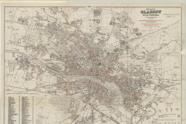
One of the earliest drink maps was printed in Glasgow, where the Glasgow United Young Men’s Christian Association distributed the document at a meeting called to install water drinking fountains across the city. Placed close to licensed premises, clean water fountains were regarded as a crucial alternative to drinking beer, which – in low alcohol volumes– had long been considered a more hygienic alternative to water, with ale long consumed as part of daily working life.
Printed in 1859 and marked in red dots, the map shows the intensity of public houses and licensed grocers along the banks of the Clyde from Broomielaw in the north and Govan in the south, where premises crowded at three to a block on the riverside and the streets parallel to the water.
By the time the map was printed, Glasgow had an active temperance movement. The Glasgow and West of Scotland Temperance Society was founded in 1829 by John Dunlop, of Maryhill, who campaigned against the consumption of strong spirit. For 99 out of 100 prisoners, the journey to the cells started with a whisky, it was said.
A parliamentary report on drink-related arrests between 1831 and 1851 found “Glasgow was three times more drunken than Edinburgh and five times more drunk than London”. Around this time in Glasgow, there was one liquor outlet for every 150 people, supplemented by the illegal shebeens that served up a mixture of whisky and meths.
Advertisement
Hide AdAdvertisement
Hide AdMeanwhile, the prevalence of coffeehouses flourished amongst support of the temperance folk with 20 such businesses up and running in Glasgow by the 1840s, including many in the Cranston’s chain. Robert Cranston, the uncle of Kate Cranston of Willow Tea Rooms fame, set up the chain of Waverley Temperance Hotels, which started in Edinburgh in 1848.
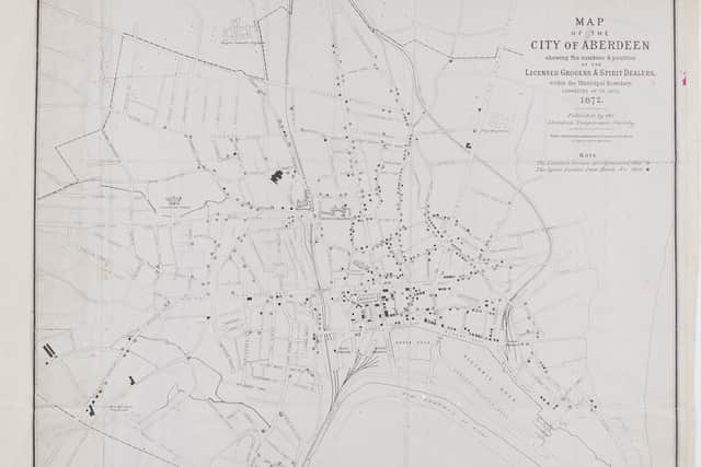
In Aberdeen, an anti-spirits society was funded in 1830 with the Aberdeen Total Abstinence Society forming in 1838. By the end of 1841, it had 10,000 members.
By 1872, the temperance movement was still going strong with the city’s drink map published. It showed grocers, licensed hotels, inns and spirit dealers concentrated around the railway station, the docks and the markets, with the dots easing as the city fans out into more wealthy neighbourhoods.
But it wasn’t just the workers who were drinking, Ms Butler wrote.
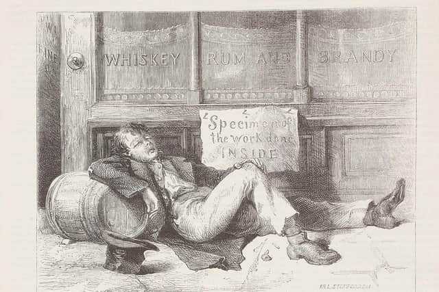
"A typical image promoted by proponents of temperance was that of people of all ages in rags stumbling around drunk or passed out in the street – which police reports at the time confirm was often actually the case,” she said. “But it wasn’t just the poor and the new working class that were tempted by a tipple. Everyone was drinking. Those of comfortable means could drink privately at home or at their clubs, where the worst result of imbibing too much was an embarrassing story the next day instead of losing money meant for the baby’s shoes.
"For those living in squalid and cramped abodes, going to the public house was as much for the improved surroundings as for the alcohol.”
Maps were printed generally in runs between 2,000 and 5,000 copies. But few were published by temperance groups after 1900, partly because other forces had succeeded in reducing the number of public houses and drinking in general, Ms Butler wrote.
The 1913 Temperance Act led to the creation of a number of dry towns across Scotland – from Kilsyth to Kirkintilloch to Wick and Lerwick – following a series of local vetoes. A further 35 ballots led to a limit on alcohol sales.
Advertisement
Hide AdAdvertisement
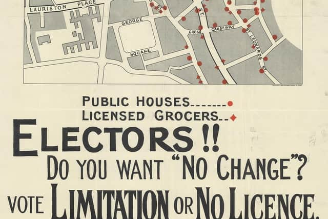
Hide AdHowever, in Edinburgh, a map was printed in 1926 to encourage against proposed new licensing laws, with the document zoning in on the Grassmarket, High Street and Canongate area.
"But as a fundamental tool of persuasion, this drink map – like those before it – arguably inspires more thirst than outrage,” Ms Butler said.
- Drink Maps in Victorian Britain by Kris Butler, published by Bodleian Library Publishing, is available on May 9.
Comments
Want to join the conversation? Please or to comment on this article.