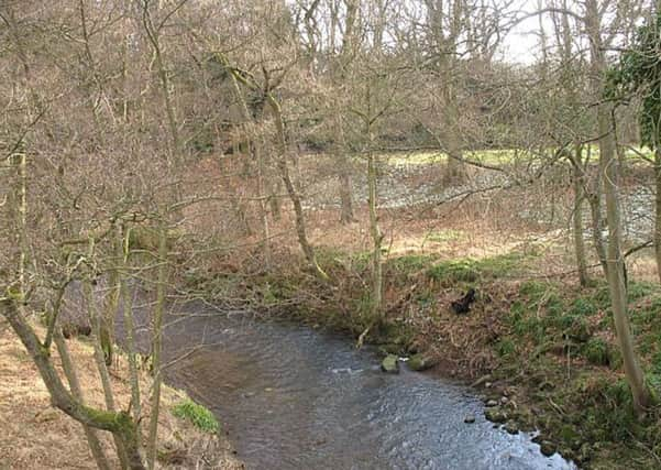
Walk of the week: The Water Of May, Forteviot


The Water of May rises in the western Ochil Hills and runs northerly past Invermay, described as one of the most romantic and pleasant spots in this part of Perthshire, to join the River Earn close to the village of Forteviot.
Once the ancient capital of the Pictish kingdom of Fortrenn and a favourite residence of Kenneth MacAlpin and Malcolm Canmore, Forteviot was rebuilt in the 1920s by the 1st Lord Forteviot in the style of an English garden city. Its admittedly attractive lawns and white painted cottages may seem at odds with the surrounding area.
Advertisement
Hide AdAdvertisement
Hide AdThe walk passes through the Invermay estate whose plethora of paths and tracks, not all mapped, may cause some confusion. I would suggest printing the appropriate section of Ordnance Survey map 58, Perth & Alloa – but on a larger scale.
Map Ordnance Survey map 58, Perth & Alloa
Distance 6 miles
Height 100m
Terrain Tracks and minor roads
Start point Forteviot Bowling Club, map ref 053175
Time 2½ to 3 hours
Nearest village Forteviot
Refreshment spot Gloagburn Farm Coffee Shop, Tibbermore
THE ROUTE
From Forteviot Bowling Club, walk past the charming village hall, opened by Sir Harry Lauder. On reaching Forteviot Church, which dates from 1778, immediately turn left (south) on the broad lane adjacent to the graveyard. The lane, muddy on our day after heavy rainfall, leads by the east bank of the Water of May, then becomes a grassy broom-fringed way between fields. Cut left, avoiding the immediate environments of a house, to reach a minor road. Turn right and cross the Water of May, then immediately left to enter the Invermay estate with a Tarmac drive leading through an attractive wooded strip which, on our day, had a beautiful expanse of snowdrops by the river bank.
Pass by the mandatory rhododendrons and some very old trees to approach two bridges across the burn of which the upstream one has been badly eroded. That bridge is barricaded. The lower one is used on return. At the junction of tracks by the bridges, straight on leads to Invermay House which dates from the late 18th century. However, take the right branch, signed Hill of Invermay and Home Farm, with the Tarmac road passing by beautiful parkland to the right. The road crosses a large pond and continues uphill to the massive mansion that is Hill of Invermay. At this point turn left (east) on a track. Cross the small burn and branch left, passing by an impressive high tree hut, and through another stretch of lovely open woodland to reach the edge of the very large wooded gorge, albeit with the Water of May hidden to view.
Pass on the left the remains of Muckersie Chapel, roofless but quietly evocative, sited on a bluff overlooking the Water of May. It continued to be used for worship until circa 1638. It was then refurbished in the mid 19th century to provide a mausoleum and chapel for the Belsches who had acquired Invermay in 1717.
Turn left on reaching the minor road and pass Ardargie Cottage, then turn left at a junction, signposted Forteviot 2 miles. Pass on the left the road giving access to the Ardargie new homes development. Turn left by Ardargie North Lodge, signposted Forteviot 3 miles! Have these signs been switched? A long gentle descent then leads to a track on the left to return to the lower of the two bridges, from where retrace steps to Forteviot. Due to excessive rain, the track was muddy and the ground churned up by timber operations of which there was no activity on our day. Thinking of the mess his two dogs were likely to get into, Jimbo continued by the minor road.