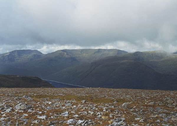
Walk of the week: Toll Creagach


Using the Loch Mullardoch ferry boat for access, in early July Rhona and I followed the start of that path to climb Tom a’Choinich. However, the ferry is not available during the stalking season so to tackle 1,054m/3,458ft Toll Creagach during September and October the Glen Affric approach is required.
The name commonly attributed to Toll Creagach is rocky hollow, another example of a feature at a lower level giving its name to a hill. Hill of the rocky hollow sounds better. Yet too often it is used to describe a small, almost hidden corrie such as Toll Easa. Hill of the hidden rocky corrie sounds even better; a more appealing resonance to what is really a bland Munro, albeit one that serves as a gateway to more exciting prospects further west – a superb high-level ridge traverse on the north side of Gleann nam Fiadh to the distant Carn Eighe and Mam Sodhail. Sleeping out on the hillside allows for the easier option of a two-day traverse.
Advertisement
Hide AdAdvertisement
Hide AdSome years ago, after a long day in Glen Affric, Geraldine and I camped by the shores of Loch Beinn a’Mheadhoin. Aware of the poor forecast for the following day, we decided to climb Toll Creagach that evening, leaving at 9pm, somewhat tired after our exertions of the day. Appreciating the long rest at the summit, we could so easily have stayed longer, admiring the late evening views – and the disappearing sun. The walk back on the track was in complete darkness. We slept very well that night.
MAP Ordnance Survey map 25, Glen Carron & Glen Affric
DISTANCE 9½ miles
HEIGHT 850m
TERRAIN Track and stalkers’ path to grassy slopes
START POINT Car park, map ref 216242, by bridge over Abhainn Gleann nam Fiadh
TIME 6 to 7 hours
NEAREST VILLAGE Cannich
REFRESHMENT SPOT The Priory Hotel, Beauly
THE ROUTE
Start from the car park, map ref 216242, by the bridge over the Abhainn Gleann nam Fiadh, one mile east of the west end of Loch Beinn a’Mheadhoin. A track on the east side of the river goes round the shoulder of Beinn a’Mheadhoin, from which the loch takes its name, and passes through the Coille Meallan reserve to reach a junction of the track at map ref 203257. Continue west into Gleann nam Fiadh, glen of the deer, passing below the rough ground and crags of Beinn Eun.
Although a northern approach from this point, over grassy slopes then stonier terraced terrain, gives the most direct route to the summit, a more satisfying day is achieved by following a clockwise route via Bealach Toll Easa. Continue further west into the glen, cross the Allt Toll Easa then follow the west bank path which zigzags northwards, easing the 400m climb to the bealach. (From there an out and back trip to Tom a’Choinich takes little time. The well-worn path follows the line of the ridge and sporadic metal fence posts).
From the bealach a short climb leads to the mapped 951m bump, a subsidiary Top simply tabled as West Top. (This was originally listed as Top north of Allt Toll Easa, a better description in my opinion). By now on the mile-long SW ridge, really a broad shoulder, it is an easy stroll with a gentle drop of less than 30m before the final 100m climb to the small rounded summit dome of Toll Creagach. A cairn a few yards west of the trig point marks the highest point.
Descend almost due south to return to the glen, but on a misty day it is prudent to avoid the crags of Beinn Eun. Take a bearing for the east bank of the un-named stream east of Allt a’Choire Odhair.