Walk of the week: Sgurr Mor and Beinn Liath Mhor Fannaich


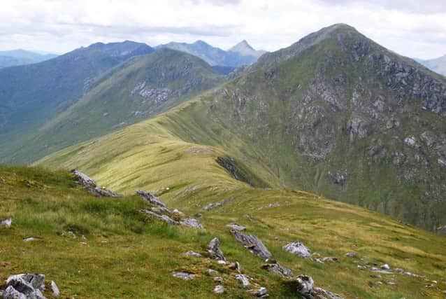
When viewed from the Ullapool road it has a commanding presence, with the shape and grandeur of a sharp-pointed Alpine peak, especially when snow-capped. For all that, the conical summit occupies but a small area and is only reached after traversing another hill, more often than not the less commanding 954m/3130ft Beinn Liath Mhor Fannaich, Big Grey Hill of Fannaich, a bouldery bump on Sgurr Mor’s narrow connecting north-east ridge.
The re-ascent from Sgurr Mor to Beinn Liath Mhor Fannaich is only 114m, but with over a mile between the hills the latter deserves its Munro status – a pleasing hill to climb, different in character and shape from its neighbour. Both hills are invariably climbed from the north, a route described below. There are no subsidiary tops.
Advertisement
Hide AdAdvertisement
Hide AdI visited both hills on what was basically a wet day of periodic showers, some very heavy, and the cloud scarcely lifted above the summits; an atmospheric day of navigation. On the way up I met a wet trio, part of an overnight Fannaich group, heading for their pick-up vehicle and a hot drink at the Loch Droma dam. Later I came across waterproof trousers, presumably dropped by the wet trio; trousers now at home awaiting any claimant.
FACTFILE
Map Ordnance Survey map 20, Beinn Dearg & Loch Broom
Distance 9 miles
Height 1000m
Terrain Mixture of track, rough path and stalkers’ path
Start point Parking place at west end of Loch Droma, map ref 253754
Time 6 hours
Nearest town Ullapool
Refreshment spot The Ceilidh Place, West Argyle Street, Ullapool
THE ROUTE
The parking space opposite Lochdrum at the western end of Loch Droma is at a helpful height of 270m. Cross the dam and follow the track, at first alongside an extraction pipe that feeds Loch Droma. The track crosses a stream where there is a warning sign – do not pass when gates are closed – danger, sudden highwater flows, scour channel in operation. I have never seen the gates closed.
Continue on the track to where it dips to cross by bridge over the Allt a’Mhadaidh (then continues by the north bank, shown as a path on my map). However, stay with the lesser track on the south bank to reach a small dam, a water extraction point.
Advertisement
Hide AdAdvertisement
Hide AdHead SW, at first following a vague and wet boot path that heads through tussocky, heathery ground towards steeper, stonier slopes, west of the escarpment overlooking Loch Sgeireach. The path fades but it is faster and easier walking once on the gently rising mossy stone-strewn plateau. Pass a marker cairn, and turn south. Reach the start of unmapped stalkers’ path, which serves as a quick route towards Sgurr Mor.
At this point, slant SE, then south to seek out grassy runnels that ease the climb on the stony summit cone where there are two close-by cairns. As the west side summit area is extremely bouldery, retrace steps to the start of the stalkers’ path which then eases the traverse of the boulder-field to reach the dip on the ridge at 840m – only 270m to climb to Sgurr Mor. Follow the path, at first traversing a flatter area, to reach a stone shelter (map ref 207716) tucked in on the north side of the path – a handy spot in bad weather.
A short distance beyond, leave the stalkers’ path for the worn boot path that leads west then zigzags northwards on steep grassy slopes. The large summit cairn is very close to the edge of crags on the right. The easiest return is to retrace steps.