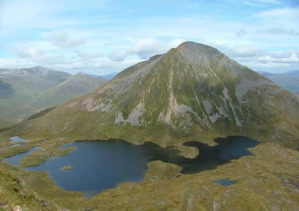
Walk of the week: Sgurr Eilde Mor


The complex 10-mile long Mamore range lies south of Glen Nevis and north of Loch Leven and Loch Eilde Mor. The range has ten Munros of which the most easterly is 1,010m/3,314ft Sgurr Eilde Mor. Approaches from the top end of Loch Treig, or from the end of the Glen Nevis road, involve a very long day so the hill is invariably climbed from Kinlochleven, with the sea-level start eased by one of the many stalkers’ paths in the Mamores.
A conical compact hill with no subsidiary Tops, steep quartzite scree slopes overlook Coire an Lochain, the floor of which is almost filled by the un-named lochan, with just enough flat ground to be able to walk round its perimeter. At a height of 730m, the lochan offers beautiful solitude and is a marvellous viewpoint to the south. Originally tabled as Sgor na h-Eilde and as shown on Victorian maps, Sgurr Eilde Mor was renamed in 1921 big peak of the hind, forming a counterpart to Sgor Eilde Beag on the other side of the lochan.
Advertisement
Hide AdAdvertisement
Hide AdMap Ordnance Survey map 41, Ben Nevis, Fort William & Glen Coe
Distance 8 miles
Height 1050m
Terrain Stalkers’ path to stony summit cone
Start point Grey Mare’s waterfall car park, Kinlochleven, map ref 188623
Time 5 hours
Nearest village Kinlochleven
Refreshment spot MacDonald Hotel bothy bar, Kinlochleven
Start from the free car park for the Grey Mare’s Tail waterfall in Kinlochleven, map ref 188623. Note the green Rights of Way signs for Spean Bridge and Corrour station. After a few yards turn left at the path junction, as signed for the waterfall, and then right as signed for Loch Eilde Mor. Head ENE and over a burn, beyond which the path diminishes in quality, radiating as it climbs through woodland. Once into open country, admire the superb panoramic views back down to Kinlochleven and along the loch to the Pap of Glencoe and beyond.
Cross the track, map ref 208635, marked by a small cairn. The path rises high above Loch Eilde Mor, crosses Coire nan Laogh, and traverses the southern slopes of Sgor Eilde Beag; an airy staircase looking out over Rannoch Moor, albeit one that is suffering from too many boots.
On reaching the flatter ground of Coire an Lochain, leave the path and traverse the watery area to reach the outflow at the SE edge of the lochan, an inviting resting spot. (Another path climbs from the Loch Eilde Mor track but it is rougher and steeper).
Sgurr Eilde Mor is not bulky, yet when standing in Coire an Lochain it may come as a surprise to realise there is nearly another 300m to climb. Head ENE then north, at first with a worn path on a slight ramp. Higher up, the terrain becomes rough quartzite, more easily crossed when covered by a pavement of firm snow.
The descent from the summit can be eased by continuing briefly NNE then west. However, the direct way follows the short western spur, then turns right on a well-worn zigzag stony path, descending by scree to the north end of the lochan. On descent I was passed by a hill runner intent on covering the Mamore range in one day. Although aware of the lie of the land, he had lost his map and was appreciative of a look at mine before heading off towards the other Mamores outlier, 943m Binnein Beag. (Hillwalkers should be aware that, despite another convenient path, the out and back 3-mile visit to Binnein Beag involves a significant descent into the upper reaches of Coire a’Bhinnein; an overall 500m climb to return to Coire an Lochain).
A pleasant stroll round the lochan’s western perimeter leads back to the ascent path.