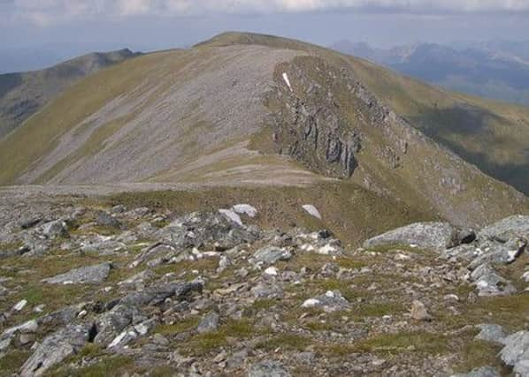
Walk of the week: Sgurr Choinnich/Sgurr a’Chaorachain


Our target was the long ridge on the main west/east watershed which boasts three prominent peak – two Munros, 999m/3,278ft Sgurr Choinnich and 1053m/3,455ft Sgurr a’Chaorachain, and then the most dramatic of the three, 1,046m/3,432ft Bidean an Eoin Deirg, a subsidiary Top one mile further east. The two Sgurrs lie within ¾ mile of each other, and with minimal re-ascent are invariably climbed as a pair. But for the want of 24ft, Bidean an Eoin Deirg, rather than Sgurr a’Chaorachain would be the Munro.
Sgurr Choinnich means mossy peak – its steep southern slopes are grassy. Sgurr a’Chaorachain has a more rounded, grassy and less rocky summit. The name may mean peak of the torrent, referring to the Allt Toll a’Chaorachain, though on old maps the name was shown as Sgurr a’Chaoruinn, peak of the rowan tree.
Advertisement
Hide AdAdvertisement
Hide AdAll three can be traversed on an approach from Loch Monar, from where Bidean an Eoin Deirg is the commanding hill, then by the delightful ridge, Meall a’Chreagain Duibh. However, the easiest approach for Munro-only baggers is from the west at Craig on the A890, sometimes first tackling Maoile Lunndaidh then to Sgurr a’Chaorachain by its north ridge, or more commonly climbing the west ridge overlooking Bealach Bhearnais. Sgurr Choinnich is one of those hills traversed to reach another Munro.
This latter route, from Craig to Bealach Bhearnais via the Allt a’Chonais, and along the west ridge, is stalking free.
Map Ordnance Survey map 25, Glen Carron & Glen Affric
Distance 14 miles of which 7 miles cycled
Height 1300m
Terrain Track and stalkers’ path then Munro path on ridge
Start point Craig car park, north side of A890, map ref 039494
Time 6 to 7 hours
Nearest villages Lochcarron and Achnasheen
Refreshment spot Ledgowan Lodge Hotel, Achnasheen
THE ROUTE
From the Forestry Commission Craig car park on the north side of the A890, map ref 039494, cross with care both road and railway. It is 3½ miles to the start of the stalkers’ path, map ref 074468 – a distance eased by a mixture of walking and cycling on a track of varying quality. The track goes east, crosses the River Carron then steeply rises through the partly de-forested area. At two junctions keep to the left. After passing through a gate to clear the forest, the track levels off by the Allt a’Chonais.
The bridge, still shown on my map at map ref 074467, is no more. Upstream at map ref 076466 is a two-wire bridge, use it at your own risk, although in late summer the river can usually be forded.
The path eases the 300m climb over almost two miles, yet Bealach Bhearnais may seem forever distant. Once there, head SE to Bealach Crudhain, then east by a brief drystane dyke. At this point what could well be seen as the second Munro is in fact Sgurr na Conbhaire on the southern ridge of Sgurr Choinnich; an easy mistake to later make on a misty day in heading south rather than eastwards to Sgurr a’Chaorachain.
A worn path winds through the few rocky outcrops to reach the long and narrow summit area of Sgurr Choinnich. The cairn is close by the edge above the small northern corrie.
Advertisement
Hide AdAdvertisement
Hide AdDescend SE on a worn zigzag way to avoid a jumbled rocky section, then cut back NE to the narrow 865m dip between the hills. There is another 134m to climb to reach Sgurr a’Chaorachain’s partly destroyed stone-built trig point within a circular cairn.
Returning towards Bealach Crudhain, don’t descend north too soon. This leads to a small ravine then a short re-ascent to reach the stalkers’ path.