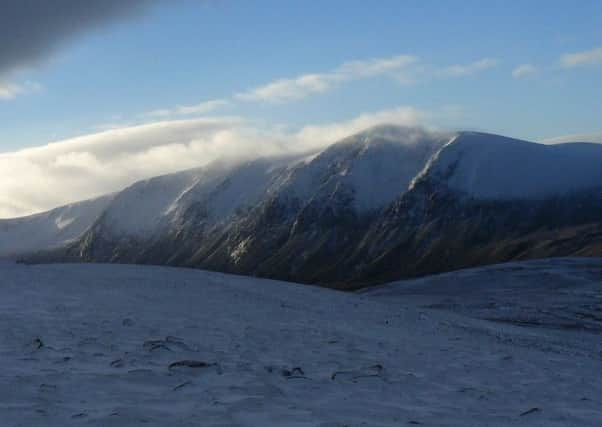
Walk of the week: Sgor Gaoith


In contrast, the western side has grassy, heathery slopes falling to Glen Feshie (Gleann Feisidh), the sheltered place from the stormy blasts. Nevertheless, the Cairngorm Gliding Club’s Feshie landing strip, just to the north, is in an ideal location to take full advantage of the up-currents prevailing on the western slopes, and from where a glider can smoothly climb to well over 20,000ft. Average flight times are said to be among the best in the country.
However, on a day when the weather forecast indicated just a gentle breeze, Jimbo and I were set to go no higher than 1,118m/3,668ft, the height of Sgor Gaoith, the highest (and most dramatic) of a line of hills on the east side of Glen Feshie, consisting of two Munros, including Mullach Clach a’Bhlair and five subsidiary Tops. Of the latter, all of which relate to Sgor Gaoith, three were Munros until demotion in 1981, Meall Dubhag, Carn Ban Mor and Geal-charn. Geal-charn and the unnamed-on-my-map 976m Meall Buidhe lie on a north-west ridge. Sgoran Dubh Mor, the fifth but finest Top, lies north of the main summit. There is no doubt that in Munro’s time Sgoran Dubh Mor was regarded as the more commanding hill.
Advertisement
Hide AdAdvertisement
Hide AdI last climbed Sgor Gaoith in 2009, using the stalkers’ path on the north bank of the Allt Ruadh, and then by the broad western ridge to reach the stony plateau just south of the summit. However, this time Jimbo and I opted for the slightly longer but easier approach from Auchlean. Our target was to traverse but one Top, Carn Ban Mor, on an easy five hour day thanks to a 300m starting height then a superb path that climbs to over 1,000m.
SGOR GAOITH
Map Ordnance Survey map 36, Grantown & Aviemore
Distance 10 miles
Height 900m
Terrain Road then superb path to plateau
Start point Glen Feshie car park, map ref 852985
Time 5 hours
Nearest towns Newtonmore, Kingussie and Aviemore
Refreshment spot The Tipsy Laird, 68 High Street, Kingussie
THE ROUTE
From Feshiebridge go south for Auchlean to a newish car park, map ref 852985, ½ mile before the road end. It is then a short stroll to the former off-road parking area just before Auchlean. From there a broad though rough path leads south-east to join the good path from Auchlean. This is the upper of two mapped paths on the north side of the Allt Fhearnagan, a superb path through woodland, then open slopes, that makes light of the ascent. A convenient notch in the north-west ridge, at map ref 881976, may give a handy sheltering spot. The path, once badly eroded, now extends in superb pavement form to a large cairn marking its highest point at 1,030m and from where it is an easy stroll to 1,052m/3,451ft Carn Ban Mor and its large sheltering cairn.
By this time the impressive pointed peak of Sgor Gaoith dominates the sky line. A 40m NNE descent, underlining why Carn Ban More was deleted as a Munro, is followed by a gentle stroll, a 100m climb to reach Sgor Gaoith, described by Hugh Munro as being, “at the edge of a precipice of 2,000 feet, descending to Loch Eunach, (sic) grandly situated in an amphitheatre of cliffs.”
Take care on approaching the summit. On our just-above-freezing day, there was no snow, but a smooth coating of verglas. The cairn, even now but a few stones on top of a rocky outcrop, is only yards away from the sheer drop to the east; a profile of climber and crags best photographed from just to the south.
With the western Cairngorms escaping the clouds further east, we had 100 per cent visibility but alas no sight of soaring gliders.
CONNECT WITH THE SCOTSMAN
• Subscribe to our daily newsletter (requires registration) and get the latest news, sport and business headlines delivered to your inbox every morning