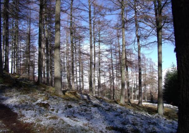
Walk of the week: Glen Tilt, Perthshire


A wander through this part of the countryside, which stretches into the wilds of Highland Perthshire, is a proper chance to escape into a world of mountains, burns and wildlife, including the ubiquitous red deer and elusive red squirrel.
The glen, as you would expect with the Dukes of Atholl being installed at the bottom, has a long history. For walkers, an important development took place in the middle of the 19th century, a turn of events which the newly formed Scottish Rights of Way & Access Society took advantage of. When the duke and his men blocked access to a group from Edinburgh University a row ensued which ultimately ended in the courts and then saw a right of way established in the glen.
Advertisement
Hide AdAdvertisement
Hide AdThe estate today is far removed from such argument and can be seen as one of the best for encouraging walkers to enjoy the scenery, while allowing traditional pursuits such as shooting and stalking to take place.
DISTANCE 9 1/2 miles.
HEIGHT CLIMBED 550ft.
TIME 3 1/2 to 4 hours.
MAP OS Landranger 43.
PARK Turn off the main road in Blair Atholl opposite the Bridge of Tilt Hotel to follow a sign to Old Blair. After just over half a mile go left, again following another sign to Old Blair. There is a car park a few hundred yards further on, on the left.
IN SUMMARY
Leave the car park by a path to the right of an information board, indicated by a yellow arrow. This passes though trees then crosses a small stone bridge over the road on which you drove in.
The path continues, high above the River Tilt, to reach a track, where you go right. After a short way look for a yellow arrow indicating a path down to the right which leads to a viewpoint looking across to the Falls of Fender. The path forms a loop to rejoin the track further on. Follow this past fields on the left until it starts to drop down, in trees. Take a path up to the left at this point, indicated by another yellow arrow. After crossing a small stone bridge, the path becomes grassy and climbs up to a track where you go right.
The track takes you to a rifle range – you should check if it is going to be in use before setting off or you may have to turn back at this point (www.blair-castle.co.uk/ranger_rifle_range.cfm).
To continue, cross a stone bridge and follow a signed track all the way down to Gilbert’s Bridge. There is a route which continues on the same side of the river as the rifle range, but the going underfoot can be rather arduous. Instead, cross Gilbert’s Bridge and turn left.
It is now up to you how far you walk up Glen Tilt, with mountainsides towering above. Remember, however, that you have to walk back the way you came. A good objective is the bridge beyond Marble Lodge, about two miles from Gilbert’s Bridge.
Advertisement
Hide AdAdvertisement
Hide AdTo return, don’t re-cross Gilbert’s Bridge, but follow the track all the way to its end, where you cross a road to re-enter the car park.
REFRESH
Blair Atholl has a good choice. Try the Atholl Arms hotel, which has a lovely bar and a fantastic dining room with stags’ heads mounted around the walls.
WHILE YOU ARE IN THE AREA
Blair Castle is a gem of country pile and re-opens to the public from 1 April (www.blair-castle.co.uk).
FOLLOW US
SCOTSMAN TABLET AND MOBILE APPS