Walk of the Week: The Duchess’s Drive, Bowhill


Mapped as Duchess’s but with apostrophe variations seen elsewhere, the Drive is waymarked with small square signs, yellow arrows with a white background; also latterly with blue/white horse-shoe signs.
With a distance of 7 miles and but 350m of ascent, it is ideal for a few hours between showers. There are excellent views all round from the high ground and I was lucky that the lowering cloud stayed well clear of 501m Fastheugh Hill and 450m Newark Hill.
Advertisement
Hide AdAdvertisement
Hide AdBowhill lies west of Selkirk by the junction of the A708 and the B7039 where the Yarrow Water is crossed by the General’s Bridge. From there a well-signed Tarmac estate road leads to the car park below which is Bowhill House, principal home of the Scotts of Buccleuch for two centuries. The House itself was closed on my day but the Country Estate is open 3 April-30 September but closed on Tuesdays outside of the Easter holidays, July and August. There is an estate fee, adults £4.50, children and concessions £3.50.
Map: Ordnance Survey map 73, Peebles, Galashiels & Selkirk
Distance: 7 miles
Height: 350m
Terrain: Waymarked tracks and estate road
Start point: Bowhill House and Country Estate car park, map ref 425279
Time: 3 hours
Nearest town: Selkirk
Refreshment spot: The Minstrel Tea Room, Bowhill House
THE ROUTE
Turn left on the estate road from the car park, then immediately slant right on a track that leads to the wooded slopes of Pernassie Hill. The many mapped side tracks may appear to be confusing, but the way is well marked. Simply follow the yellow arrow signs; a well-graded easy ascent through the charming and partly open mixed woodland, freshly green from the recent rain.
Pass by a stone seat, erected in memory of the 7th Duke of Buccleuch, on which is engraved a heart (used as part of the Douglas family crest), with the initials BQ and the dates, 1864 and 1935. The family’s full title is Buccleuch and Queensberry. Legend has it that Sir James Douglas, the Black Douglas, when bearing the heart of Robert the Bruce on crusade to the Holy Land, fell mortally wounded. However, Bruce’s heart in a silver casket was recovered and brought back to Melrose Abbey where it is buried.
Eventually reach the moorland giving good views south to the Ettrick Valley. Continue the gentle climb, turn right as signed at a junction, pass by the watershed between the Craighope and Newark Burns and by a line of grouse butts to reach a gate. From there a grassy path leads to the close-by Fastheugh Hill from where the Eildon Hills are easily spotted. Return to the track and at the next junction take the higher one round the northern side of the hill. A gently sloping plateau overlooking the Yarrow Valley leads to Newark Hill, reached by a grassy track. The prominent cairn has seen better days, but is still impressive. Return to the track. Leaving the moorland behind, the track descends north to enter the coniferous Black Andrew Wood. Exit and turn right on the estate road from where Broadmeadows youth hostel can be identified.
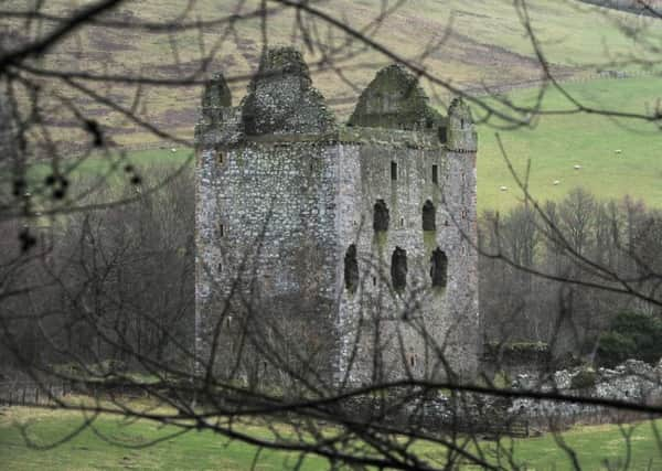
Keep left at a fork to go past Newark Castle, more commonly known as Newark Tower. Attacked a number of times in the 16th century, in 1645 the Tower became a temporary prison after the Battle of Philiphaugh. One hundred prisoners were slaughtered in the courtyard.
Continue past the Old School House, then turn right onto the main drive for Bowhill House and so back to the car park.