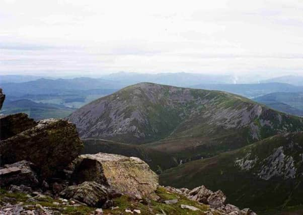
Walk of the week: Carn Liath


Dominating the skyline above Killiecrankie and easily visible from the A9.
I last climbed BCCB and then on to Carn Liath in February 2008, the day when Joe collapsed, apparently suffering a heart attack, and Jimbo spoke the never-to-be-forgotten words – “Robin, I am so pleased to see you!” Using Joe’s mobile phone, Jimbo had alerted the emergency services. A helicopter, landing on the summit plateau, whisked Joe off to Ninewells Hospital where he had a massive heart attack. But for Jimbo’s help, the helicopter rescue and the skill of the doctors, he would not have survived. Lucky Joe has now returned to the golf course, but spouse-barred hills are out of bounds.
Advertisement
Hide AdAdvertisement
Hide AdThe minor road from Blair Atholl, via Old Bridge of Tilt and Middlebridge, leads east to the north end of Loch Moraig. Jimbo, John and I travelled in my 4x4 in case the narrow, twisty road might be snow-covered. In fact the snow level was considerably higher than the road.
Park just before the junction of the private road to Monzie and a track. Loch Moraig drains both north and south (though all waters end up in the Garry), albeit invariably to the south. However, after days of heavy rain the loch had overflowed, partially covering the road. A few cars were already there. Just about to head off was my old friend Dave Hewitt and fellow walker Mike – a coincidental meeting that has happened a few times over the years.
The route
Head along that track to the hut, map ref 923679, then traverse oft-boggy ground “drained” by a minor stream – this time the worst conditions I have ever seen. The going improves on the gentle rise by the remnants of a dyke to reach the base of the hill. Carn Liath means grey peak, an apt description of the quartzite scree covered south-west slopes scarred by an eroded zigzag path, mostly clear of snow on our day.
Carn Liath was our first high top of 2014; indeed, because of the abnormal spell of deep depressions rolling in from the west, my first hill since November. The much younger and fitter John, earlier booked to carry the communal Gore-Tex bivvy bag, was by now carrying my ice axe and crampons.
It is a 550m climb, NNE then north-east, but the path eases the way to the small ice-covered summit plateau where careful walking was required. First reached is a small cairn that serves no purpose other than to confuse on a misty day, then the trig point with a large cairn a few yards to the north. With gale force winds and high chill factor, we did not linger.
On return, long strips of snow west of the path gave a quick and easy descent, with one exhilarating bum slide. Once down, this time we did not cross the minor stream, but headed across the less-wet moorland to regain the track just east of the stream, map ref 925680, which had to be crossed with care.
It was only on returning home that evening that I learned of the sudden and unexpected death of a former neighbour, Gordon Davies, better known to this column as the Mountain Lamb. He finished his round of Munros little over four years ago. We climbed many a hill together, spent numerous self-catering weeks away, and his sudden demise has brought back many a fond memory of a very kind man.
Ordnance Survey map 43, Braemar & Blair Atholl
Distance 5 miles
Height 650m
Terrain Track then boggy traverse to zigzag path
Start point Loch Moraig, parking before the private road to Monzie
Time 3 to 4 hours
Nearest village Blair Atholl
Refreshment spot Ballinluig Transport Café