Walk of the week: Cameron Bridge to Leven


In 1861 the Leven Railway and the East of Fife Railway merged to form the Leven & East of Fife Railway and the line was eventually extended to St Andrews to complete the Fife Coast line. During this period numerous other lines were built to serve the Fife coalfields.
Passenger services from Leven to St Andrews were withdrawn in 1965, freight a year later. Passenger services between Thornton and Leven ceased in 1969, though the railway was partially used until 2001 as a freight line to Cameron Bridge distillery and the Methil docks and power station. A short stretch between Thornton and Earlseat has now reopened to carry coal from the opencast mine.
Advertisement
Hide AdAdvertisement
Hide AdThe Levenmouth conurbation and the East Neuk is by far the largest Scottish urban area not served by any direct rail link. The Levenmouth Rail Link is a project to re-connect Leven with Thornton North Junction and the Fife Circle Line. Supporters argue that reopening the line, currently to cost £76.8 million, offers a much stronger case than most other similar proposals.
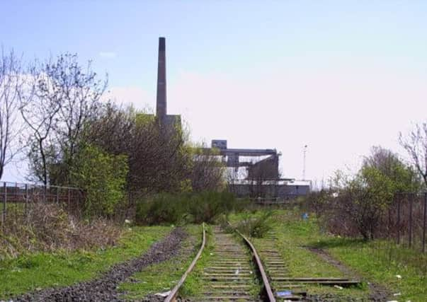
Time will tell, but in the meantime the track bed from east of Cameron Bridge offers a pleasant walk to Leven, with a path return by the River Leven.
CAMERON BRIDGE TO LEVEN
MAP: Ordnance Survey map 59, St Andrews, Kirkcaldy and Glenrothes
DISTANCE: 5 miles
HEIGHT: Negligible
TERRAIN: Path by railway track bed and riverside
START POINT: Windygates roundabout car pak, map ref 350006
TIME: 3 hours
NEAREST TOWNS: methil and Leven
REFRESHMENT SPOT: Carlton Coffee House, Balbirnie Street, Markinch
THE ROUTE
Jimbo met me at Markinch station, then drove to the Windygates roundabout car park, map ref 350006. Head briefly uphill on the A915, then descend left by path to the track bed of the Lochty freight line, opened in 1898 but closed in 1964. Few traces of that line are still mapped, but the Tarmac path on the extant tree-lined embankment towards Kennoway gives a pretty out and back stroll.
On return, continue by Tarmac path through the A915 tunnel. The path turns right, leaving the now overgrown freight line, to join the Leven line. (The freight line parallels the Leven line for a while before merging). A lovely secluded walk, on the ballast path by the partly hidden rusty rails, eventually leads to the 20-acre site of the Kingdom of Fife Preservation Society at Kirkland Yard. The society aims to create a heritage railway and transport museum of rolling stock.
From this point, the line of the track bed to Leven Station has been obliterated by urban developments. The old station too has gone though the site can be identified at the end of Station Road by the Station Bar. The proposed new station would be at Kirkland Yard.
Advertisement
Hide AdAdvertisement
Hide AdKeep to the river side of the yard, with a narrow path leading to the once freight line to Methil power station. Where the River Leven empties into the Forth, pass under the single-span 1957 bridge; still known locally as the “Bawbee Brig”, from a previous toll bridge. A grassy area on the left leads to the Levenmouth sports centre.
Cross the Bawbee Bridge and turn right on the Leven Valley footpath on the south bank of the river. Cross the minor road bridge to the north bank, then left on a Tarmac path close by the old creosote works.
Cross again to the south bank, once the site of the steelworks, and continue upstream passing through Kirkland Woods. Eventually go down to the turbulent river by a weir and follow the path which is on top of an old pipe line. The Leven, by now a placid stretch of water, was home to a heron on our day. A fisherman declared that the water was sufficiently pristine to hold salmon. Reach a footbridge and cross to regain the merge point of the railway lines.