Walk of the week: Burn O’ Vat, Loch Kinord


At first it looks like a difficult undertaking, but it is worth remembering that Queen Victoria once managed it.
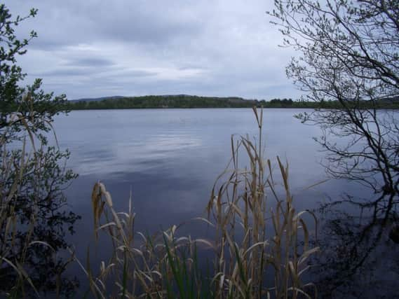
The nearby Loch Kinord makes for a quieter stroll with woodlands, birdlife and the water to admire – as well as a crannog, the site of a former castle and a rather good Pictish stone.
Advertisement
Hide AdAdvertisement
Hide AdAll of this is within the Muir of Dinnet National Nature Reserve, and by combining two of the waymarked trails a good walk can be enjoyed.
DISTANCE 5 miles.
HEIGHT CLIMBED 170ft.
TIME 2 to 2∫ hours.
MAP OS Landranger 37.
PARK The Muir of Dinnet National Nature Reserve Visitor Centre is one-and-a-half miles up the B9119 from the A93 between Ballater and Dinnet.
IN SUMMARY Follow a path to the left of the visitor centre, which then passes to the left of some toilets, through mixed woodland and next to the small Vat Burn. On reaching a second footbridge, don’t cross but go straight ahead to visit the Burn o’ Vat. The path ends at a jumble of boulders – it is actually quite easy to clamber over them and through a narrow gap in the rocks to reach a chasm carved by centuries of water. Even if water levels are high, you should be able to manage it with the help of some stepping stones.
Once you have admired the natural phenomenon, return to the second footbridge and cross it. A steep-ish path then leads high above the little glen through pines. At a junction go right, following a waymarker, to reach a viewing platform overlooking Loch Kinord.
Continue down the path to return to the visitor centre car park, where you could cut the walk short.
But to continue around the loch, cross the road and follow a sign for the Loch Kinord Trail, along a path. Almost immediately go right at a junction to follow a path that bears left and crosses a footbridge.
At a junction near a stone wall go straight on, then straight on again at the next waymarked junction. It is about a mile from the car park before you reach the loch side, after a marker post has pointed you left. The path then continues in a counter-clockwise direction round the loch.
Advertisement
Hide AdAdvertisement
Hide AdOnce you are halfway round ignore a path to the right, leading to Dinnet. The loch path continues to a farm gate, which you go through before ignoring a marker post pointing right for a car park.
Carry on near the loch and after an information post about Castle Island (just off shore) bear right to reach a 1,200-year-old Pictish stone – one of the finest in Scotland. Pass this and bear left on reaching a stone wall. Keep left at a couple of junctions and continue to a clearing with a commemorative stone.
On the other side of the clearing the path continues the last few hundred yards, via marker posts, to the junction near the visitor centre. Go right to recross the road to the car park.
REFRESH There is nothing at the start of the walk, Dinnet is closest, or try Ballater or Aboyne.
WHILE YOU ARE IN THE AREA The Glen Tanar estate is a good place to head. It offers activities including fishing and “Estate Safaris” in 4x4s (www.glentanar.co.uk); also on the estate is an equestrian centre providing treks and tuition (www.glentanarriding.co.uk). n