Walk of the week: Beinn Fhionnlaidh


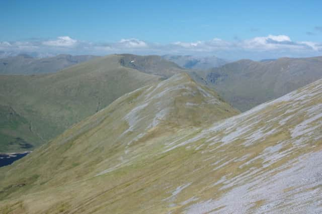
Although all of modest height, the rough terrain demands a very long summer’s outing if all three are to be climbed on the same day. Not to be confused with its namesake overlooking Loch Mullardoch, 959m/3146ft Beinn Fhionnlaidh, Finlay’s Hill, the central peak, is a shy, retiring hill, the top of which is not immediately visible, as if not wanting to be photographed. The hill can be tackled from either glen.
On a previous visit, Rhona and I started from Glen Etive; the shortest, most popular route, which may take only four hours if a bicycle is used on the track through Glenetive Forest. My diary noted “clear blue skies, warmth in the sun despite sub-zero temperature, superb visibility and a modest breeze; pleasure enhanced by the recent stormy weather” almost identical words to describe the current visit, this time from Glen Creran with Jimbo, John and Scott, and two springer spaniels.
Advertisement
Hide AdAdvertisement
Hide AdThe longer drive is rewarded by the relative quietness of the chosen hill route. Beinn Fhionnlaidh’s three-mile long WSW ridge is often referred to as a whale back, but with its many outcrops and false summits it is nowhere near as smooth as the whale back ridge on Beinn na Lap. Most of the other slopes are steep and craggy. There are no subsidiary Tops.
Map Ordnance Survey map 50, Glen Orchy & Loch Etive (and map 40)
Distance 9 miles
Height 1,000m
Terrain Private road and track to undulating ridge
Start point
Glen Creran road end car park, map ref 035488
Time 6 to 7 hours
Nearest villages
Connel and Ballachulish
Refreshment spot Loch Leven Hotel, North Ballachulish
The route
Drive to the end of the public road in Glen Creran (anglicised from Creuran) where the car park, map ref 035488, can sometimes be a midgy spot. Straight ahead is the footpath route to Ballachulish, however head east from the two stone pillars. The charming road gives a flat, relaxing start over the River Creran and so to Glen Ure, once the home of Colin Campbell, victim of the notorious Appin murder of 1752.
Turn NNE on a track and cross a burn to reach the edge of the wood, map ref 046485. Follow a branch track that climbs through the trees. From the track-end head east, then ENE, on the widening open hillside area between streams; surprisingly broken country, giving a feeling of going against the grain of the land, albeit nowadays there is a distinct path in places. Our escape to the peaceful hill was temporarily disturbed by the noise of construction work for a new track on the lower slopes of Beinn Sgulaird.
With the WSW ridge becoming more defined, head east to Lochan Cairn Deirg, the largest of three lochans. There is a feeling of exploration as the ridge narrows over the false summits; a traverse over knobbly outcrops that may take longer than expected. With a number of points on the rock-strewn summit all of much the same height, the trig point is the obvious marker on a misty day. The rocky summit offers excellent views, not only to Glen Coe but south-east to the Ben Starav group, and south-west to the sea, to Mull and beyond. It is a shame that Beinn Fhionnlaidh, usually regarded as a one-hill day, is often climbed in poor weather.
We met only one other person, a brief, almost silent, encounter. We had carried full winter gear, just in case, but it had soon been obvious that ice axes and crampons would not be needed. However, with the grassy lower slopes awash with snow melt, it was a slow and tedious descent. On a misty day, have a close regard to compass bearings even on the lower slopes and keep clear of the crags above the Allt Bealach na h-Innsig.