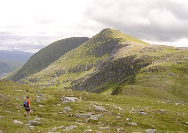
The walk: Lurg Mhor and Bidein a’Choire Sheasgaich


Common approaches start from Craig, taking the track and path to Bealach Bhearnais and over Beinn Tharsuinn, or from Achintee, south of Strathcarron railway station, using a stalkers’ path.
However, both hills can be tackled over two days by cycling/pushing bikes on the seven-mile track from Attadale to Bendronaig bothy for an overnight stay, then climbing the hills early next morning. This was the leisurely approach Jimbo and I used, albeit in July.
Advertisement
Hide AdAdvertisement
Hide AdOur evening at the bothy was a most convivial one; nine of us including four walkers doing all or part of the Cape Wrath Trail.
A graceful and conical peak, its airy narrow summit guarded by crags, 945m/3,100ft Bidein a’Choire Sheasgaich, pinnacle of the corrie of the fallow cattle, is usually referred to as “cheesecake”; a compact hill with no subsidiary Tops. If any Munro merits the label “pocket battleship”, then this is it.
Lurg Mhor, 986m/3,235ft, overlooked in grandeur if not in height, has the most remote of all subsidiary Tops, Meall Mor, more worthy of a visit than the parent Munro and which involves a very fine scramble over the jagged connecting ridge. Lurg Mhor means long shank, an apt description of this ridge which extends east to overlook Pait Lodge.
Use the hillwalkers’ park by the A890, south of Attadale House, map ref 924387, at the entrance to the estate grounds. (The gardens and nursery are open until the end of October.)
Do not be misled by the first mile, a flat Tarmac road and track to the bridge over the River Attadale. The next section to the 350m watershed beyond Loch na Caillich is mostly steep and rough, with only a few parts cyclable. Thereafter it is mostly a gentle descent to the bothy where bikes should be left. Allow three to four hours for the cycle in and out. The miles, height and time quoted refer only to the bothy/hill section. Do have a look at the letters pinned to the main room wall; one of which is from Jim Wyllie, aka Jimbo.
From the bothy it is an easy early morning walk on the track to a swing bridge, map ref 018392, and so into Coire na Sorna and on to the west end of Loch Calavie. Climb NNE, then NE, on easy grassy slopes to the 735m dip between the two Munros, then ESE and east over stonier terrain to the summit of Lurg Mhor. Take care on return to go west then NW, as the lie of the land may pull you too far west (left) into a craggy area.
From the 735m dip climb NW on grassy slopes, then north over steeper terrain to the rocky cone where only a few stones are available to mark the narrow highest spot. My sister, Frances, completed her round there in 1981. On a soaking wet day, out came the mandatory bottle of champagne. The cork soared into the mist and instantly, as though cleaved by the cork, the clouds rolled away.
Advertisement
Hide AdAdvertisement
Hide AdDescend SSW for a short distance, pass by a lochan, then follow the delightful long SW ridge to Sail Riabhach. Steeper grassy slopes lead back to the track in Coire na Sorna.
Map Ordnance Survey map: 25, Glen Carron & Glen Affric
Distance: 9 miles
Height: 1,000m
Terrain: Track and grassy slopes to stonier summits
Start point: Bendronaig bothy, map ref 014389
Time: 6 hours
Nearest village: Lochcarron
Refreshment spot: Waterside Café, Main Street, Lochcarron