Scottish walks: My battle at Sheriffmuir


Mapped as Sheriff Muir, it is where the Battle of Sheriffmuir was fought on 13 November 1715 – an unlikely place perhaps to visit on a wet, gale swept January day. Nevertheless, the approach from Dunblane is more sheltered than I had imagined and once on the moorland I met a number of fellow outdoor enthusiasts. With a visit to the Clan MacRae monument and the Gathering Stone, then a minor road stroll to the Sheriffmuir Inn for mid-walk refreshments, the bracing, but invigorating, outing became a day to remember.
The battle was fought between a Jacobite army composed largely of Highlanders under the command of the Earl of Mar and a Hanoverian army consisting mainly of regular British soldiers under the Duke of Argyll. The result was inconclusive. “Some say that we won, and some say that they won, and some say that nane won at all”.
Advertisement
Hide AdAdvertisement
Hide AdHowever, failing to take advantage of Argyll’s smaller army, Mar’s subsequent withdrawal from the field contributed to the failure of the Rising.
Although Ordnance Survey map 57, Stirling, covers the walk, I recommend the more detailed local pamphlet, Dunblane Community Paths, available from the Public Library in upper High Street. It is a steady rise eastwards through the town and whilst the urban directions may seem somewhat involved, in reality the way is quite obvious.
Map Ordnance Survey map 57, Stirling & The Trossachs
Distance 7½ miles
Height 250m
Terrain Partially waymarked path and minor road
Start point Dunblane railway station
Time 3 to 4 hours
Nearest town Dunblane
Refreshment spot The Sheriffmuir Inn, Sheriffmuir, Dunblane
From Dunblane station, Stirling Road leads to the Allan Water. The bridge is closed to traffic, but not pedestrians, until April – due to strengthening works. Head left up High Street; pass by the Andy Murray golden post box and so to Dunblane Cathedral. Turn right up the narrow and attractive Sinclairs Street (to the right of which is the public library) to reach Smithy Loan and turn left heading for the Perth road.
Cross over, turn right, pass the entrance to Dunblane Hydro, then turn left into Newton Loan. A footpath leads to a road and continue up Ochiltree. Another Tarmac path, briefly right and left, leads to Newton Crescent, then right and left again to Leighton Avenue. Turn right on a signposted track, public path Sheriffmuir 1 mile.
Given the recent rain it was not surprising that the track, reverting to a path, was extremely muddy. On passing Dykedale farm steading, follow the narrow path on the right (and the sign – all dogs must be kept on leads) and into the mixed woodland. Reach a track and follow that to the right to a T-junction – to the right open terrain; to the left a plantation.
The pamphlet describes a way-marked path between two conifer plantations which may suggest turning left. Not so. The confusion is caused by the now felled area on the left. Bisect both tracks and continue NE on the path which weaves by the edge of the wood, latterly following a dyke and open moorland on the right. Eventually reach the Sheriffmuir road by a path junction – Dunblane 2 miles and, uphill to the left, the Gathering Stone ½ mile. The latter path leads to heathery moorland then curves left to the Gathering Stone, a fallen prehistoric standing stone only popularly associated with the battle and bizarrely protected by an iron ribbed cage.
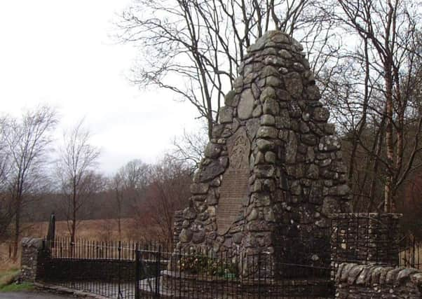
On return to the road, admire the large 1915 obelisk monument to the Clan MacRae and the nearby small cairn and plaque erected by the 1745 Association.
Advertisement
Hide AdAdvertisement
Hide AdHead east, passing under the new Beauly/Denny line of massive pylons to reach the Sheriffmuir Inn, a remote 17th-century stone-built droving inn on the old coach road to Perth. Leave boots in the porch. On the return leg, retrace steps rather than following the road all the way back to Dunblane.