Maps reveal secrets of Scapa Flow shipwrecks


Now a team of scuba divers have created a series of interactive maps detailing some of the best-known vessels that lie at the bottom of Scapa Flow, a vast natural harbour in Orkney.
The maps are generated from diver’s underwater photos, sketches and descriptions to provide a detailed guide to seven of the German ships scuttled in 1919 to prevent them from falling into British hands.
Advertisement
Hide AdAdvertisement
Hide AdAmong them is the SMS Kronprinz Wilhelm, a battleship launched in 1914 that saw action at the battle of Jutland.
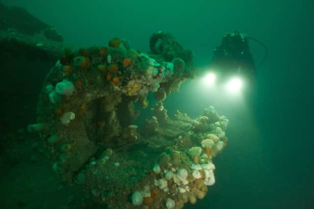
It was one of 74 Imperial German ships interned at Scapa Flow along with their crews following the Allied victory in the First World War.
Fearing the ships would be seized and divided among the victors, German commander Admiral Ludwig von Reuter decided to scuttle the fleet.
A total of 52 vessels eventually sank. Most were salvaged and towed away for scrap but several were left and later became popular diving sites.
Scuba diving artist Steve Jakeway teamed up with fellow British Sub-Aqua Club (BSAC) divers for the groundbreaking project to map seven of the remaining shipwrecks.
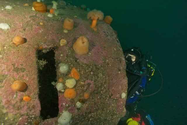
The wrecks of the SMS Cöln, SMS Kronprinz Wilhelm, SMS Brummer, SMS Karlsruhe, SMS König, SMS Markgraf and SMS Dresden all still lie where they sank off the coast of Orkney, almost 100 years ago, on June 21, 1919.
All seven wrecks have now been mapped by Jakeaway, from Gloucester, in a project to raise awareness of marine heritage and protect one of the world’s most popular wreck diving sites.
Advertisement
Hide AdAdvertisement
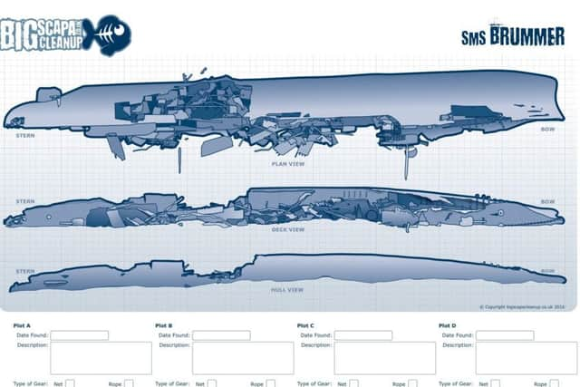
Hide AdThe resulting interactive maps, which are being published on the Big Scapa Clean Up project website, will help guide divers to explore the wrecks as they
detail the outlines of the ships and key features, such as guns.
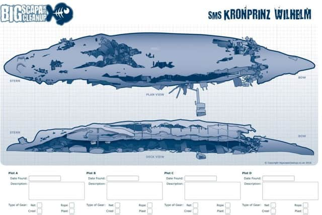
They also highlight potential hazards and litter which divers have spotted such as discarded fishing nets, which cause a phenomenon called “ghost fishing”, when old nets get snagged and continue to kill marine wildlife.
Scuba divers will be encouraged to log on-line any debris they spot on the wrecks. The data recorded will be gathered and prioritized, and then the items on the list can then be targeted for removal.
Steve explained that several dives were needed on each wreck to produce an accurate illustration.
He said: “The idea was to create a series of very simple single-line illustrations showing the layout of each wreck so divers can easily work out what they are swimming over or under, and recognise key features such as a ship’s gun.
“The Scapa Flow wrecks are all in between 12 and 45 metres of water, but the visibility is not always great. Often even experienced divers are not sure precisely what they are looking at, especially if a wreck has capsized and everything is upside-down.
Advertisement
Hide AdAdvertisement
Hide Ad“The divers took it in turns to go down and photograph each of the wrecks. In order to get as accurate a picture as possible, we also got them to make their own sketches, and describe to me exactly what they had seen, including any nets or other debris.
“The sketches from the boat together with the photographs and my notes enabled me to create the final drawings.”
The resulting drawings are being uploaded to the Big Scapa Clean Up project website.
The map of the SMS Brummer shows the minelaying light cruiser submerged in the sea bed on its side. Green diamond symbols mark were debris has been removed, including three nets, two batteries, some buckie pots, rope and even two car tyres, while the map of the the SMS Kronprinz Wilhelm shows red triangle symbols, marking where discarded buckie pots and rope have been spotted and are yet to be cleared.