'˜Honest' map reveals Culloden as written by the losers


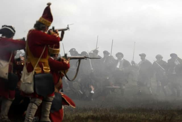
As every Scot knows, the battle fought at Culloden Moor on the 16th of April 1746 - the last pitched battle fought on British soil - ended in a shattering defeat for the forces of Charles Edward Stuart.
It spelled the end of a year-long rebellion which had threatened to rip the United Kingdom in two and reinstall a Catholic monarch to the British throne.
Advertisement
Hide AdAdvertisement
Hide AdAn estimated 3,000 men died on the battlefield, however, only one third of that total perished in action, the remainder were wounded soldiers slaughtered in the aftermath.
The map ‘A Plan of the Battle of Culloden’ is a contemporary record of Culloden drawn up by cartographer John Finlayson who fought at Culloden as an artilleryman for the Jacobite Army.
Experts believe the map dates from the time of the battle, due to the fact that Fort George, designed in 1747, appears as an outline on the Ardersier peninsula.
The plan gives us a good sense of the considerable challenge faced by Charles Edward Stuart’s Jacobites as they prepared to clash with a much larger and better-equipped Hanoverian Army.
Fascinating details include a depictions of the English supply ships making their way up the Moray Firth, and of their camp at Nairn.
Also included is the path the Highlanders took the night before the battle when they attempted in vain to surprise the ‘Duke in his camp’. The Highlanders got as far as Culraick, 4 miles from the encampment at Nairn, when the attack was thwarted. The result meant the Jacobean troops faced a 20 mile trek on foot back to camp, with little or no sleep for the coming battle.
Similarly, Finlayson has also marked out the paths the Highlanders took as they fled from battle. The lines of ‘flight’ spread out towards Inverness and the west.
Advertisement
Hide AdAdvertisement
Hide AdAccording to map historians, Finlayson’s ‘first-hand account’ of the battlefield and the events which took place should be taken with a pinch of salt, as his allegiances may have skewed certain facts to fit Jacobean agendas.
Chris Fleet, map curator at National Library of Scotland explains: “This is a very special map, though certain visual elements of what we see here do have to be treated as propaganda - .
“The draughtsman (John Finlayson) was an engineer in the Jacobean Army and a close companion of Bonnie Prince Charlie. We have to imagine that for him personally, the defeat would have been a very significant blow and there would have been a great deal of sentiment attached when producing this”.
The map certainly doesn’t beat about the bush in admitting that Culloden was a crushing defeat - as evidenced by its inlays, which include a unicorn with a broken horn, a lion in chains, a pair of snapped thistles, a fallen soldier, and an extinguished candle. There is a real sense of despair at play here, something Mr Finlayson doesn’t attempt to hide.
In his ‘observations’ on the left hand side, Finalyson also explains that the Highlanders had been “obliged to fight, after a fatiguing march, without any refreshments, having had no sleep and but little food the two days and nights immediately preceding”.
According to map curator Chris Fleet, this account is what makes the map so unique: “Hanoverian map records of this battle would never have felt the need to explain why the Jacobites lost, other than the fact they had been rightfully defeated.”
John Finlayson’s map, while clearly alluding to the Jacobite cause, manages to present the events in an open and honest manner which doesn’t shy away from admitting defeat at Culloden and the fierce sense of disappointment which accompanied it.