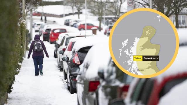
Scotland weather: This is when experts predict snow will fall across Scotland as the Met Office issues yellow snow and ice warnings


Frequent snow showers will affect many northern and eastern parts of the UK this week, which may lead to travel disruption, according to the Met Office.
The Met Office issued a yellow warning of snow and ice – already in place – which will last until Wednesday, February 10 at 11.59 pm in most northern and eastern parts of Scotland.
Advertisement
Hide AdAdvertisement
Hide AdThe initial yellow snow and ice warning – which also affects more of northern and central Scotland today – will last until 11.59pm tonight.
This warning will then shrink in the central belt and turn into a specific yellow snow warning which will affect most of northern and eastern Scotland until Wednesday night.
Snow is expected to accumulate in the period with icy stretches developing and many parts seeing 2-5 cm of snow, with 10-15 cm possible, especially above 200 m in northern England and Scotland.
Areas affected by the yellow snow and ice warning today include south west Scotland, Lothian Borders, Orkney & Shetland, Grampian, Central, Tayside and Fife, Highlands and Strathclyde.
Some roads and railways are likely to be affected by snowy and icy conditions in these areas with longer journey times by road, bus and train services.
There is a small chance of longer travel delays in places along with delayed or cancelled rail and air travel.
Some injuries from slips and falls on icy surfaces are also expected with a slight chance that some rural communities could become cut off.
There is a small chance that power cuts will occur and other services, such as mobile phone coverage, may be affected.
Advertisement
Hide AdAdvertisement
Hide AdA Met Office Spokesperson said: “Snow showers will feed off the North Sea into many northern and eastern areas of the UK.
"Whilst some areas in the warning area will remain largely dry, some persistent bands of showers are likely to develop in places.
"Widespread daily accumulations of 2-5 cm are probable, with 10-15 cm plausible in areas where showers merge into more organised and prolonged spells of snow.
"Icy stretches will likely form widely overnight, especially in areas where there has been a partial melt of lying snow during the daytime.”