Images that put Scotland on the Landranger map


And that’s just for the judges of a national competition in which more than 15,000 photographers sent in their favourite shots.
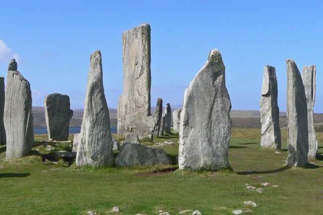
But a quick glance at the winners, depicting many of the nation’s best-loved beauty spots, proves all efforts have been worth it.
Advertisement
Hide AdAdvertisement
Hide AdScotland on Sunday can now exclusively reveal the images we have chosen to feature on the latest editions of Ordnance Survey’s prestigious Landranger series.
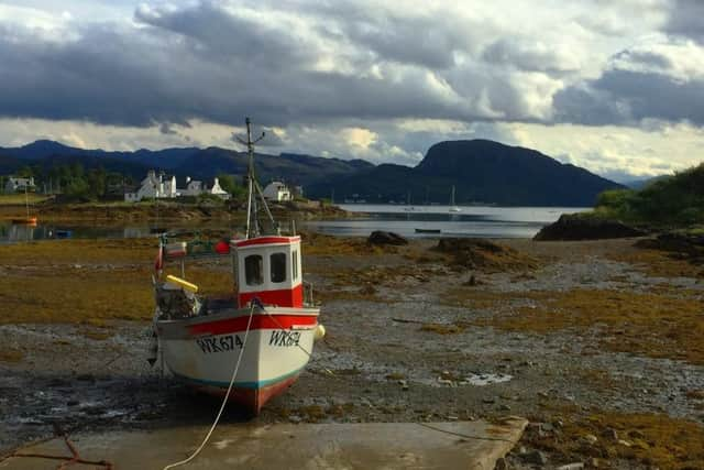
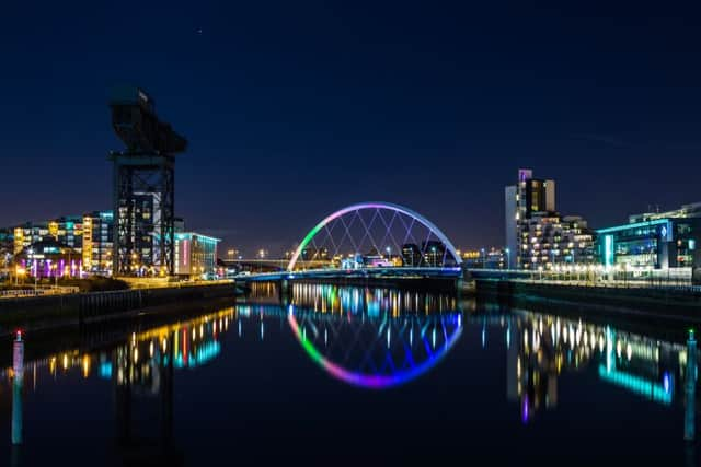
Amateur snappers from across the UK have immortalised everything from Scotland’s ancient natural masterpieces to some of its most striking architectural landmarks. Among the winners is Glasgow-based Neil Barr, who first picked up a digital camera only 12 months ago after selling off his web design business.
His images will grace the covers of two of the new maps – those for his home city and for Stranraer and Glenluce.
He said: “At the beginning I was going out nearly every single day, regardless of the weather. That was probably a bit daft but after a while I realised it was something I wanted to keep doing rather than getting a new job.
“Nowadays I go out once or twice a week, often camping to save money. I was out yesterday, up a mountain in Glencoe. It was absolutely freezing.
“Maps are essential for what I do. I need to study maps to decide locations, work out where the sun is going to be and that sort of thing.
“They are absolutely vital, so I’m delighted my pictures have been chosen for the covers of these Landranger maps.”
The 45-year-old former web designer and art school graduate now hopes to turn his passion for landscape photography into a career and is staging his first solo exhibition early in the new year.
Advertisement
Hide AdAdvertisement
Hide AdHe has ambitions to expand his portfolio of Scottish artworks at the same time.
“I’d like to explore further north,” he added. “I would also like to return to Skye – it’s a pretty special place.”
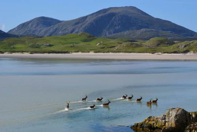
Roger Vander Steen, a retired teacher living in Edinburgh, was also successful in more than one map area.
He is particularly pleased that his photograph of Ben Nevis has been picked to appear on one of the country’s most popular sheets, which covers the area surrounding the country’s highest mountain.
He said: “My wife and I have always been hillwalkers and I just love taking pictures of Scotland. There is so much that is beautiful. I have been photographing the hills for many years, but digital technology has revolutionised it. It means ordinary people like me can easily take a superb picture. And I just love doing it.”
National map-making agency Ordnance Survey was founded in 1791, publishing its first map in 1801. Though digital data services account for much of the business at the government-owned firm today, paper maps remain an important element.
In fact, sales of paper products have this year been increasing for the first time in more than a decade. Despite all the latest advances in portable satellite systems, however, outdoors organisation insist there is no substitute for traditional navigation methods.
“Maps can be a source of endless fascination and inspiration once you get to understand the way they display information,” said Helen Todd, campaigns and policy manager at Ramblers Scotland.
Advertisement
Hide AdAdvertisement
Hide Ad“They show us what our land looks like and help us plot a route through it, whether it’s a wander on the edge of town or an expedition into a distant glen.
“Maps give you the confidence to head off into the unknown safely, and the photos on each cover are a great source of motivation.
“Nowadays mobile phones or GPS devices are often used for navigation, but batteries may fail or a signal can be weak or non-existent in many areas.
“Knowing how to navigate using a map and compass is a fundamental skill for any walker to learn – with these in your backpack you’ll always know which way to go.”
The new Landranger maps will be available from February next year.