Storm Darcy: Interactive satellite slider map shows Scotland blanketed in snow amidst coldest temperatures in a generation
February has been marked with snow and ice across the country with travel disruption on the roads and railways.
Three separate yellow weather warnings for snow and freezing temperatures cover almost all of mainland Scotland today.
Advertisement
Hide AdAdvertisement
Hide Ad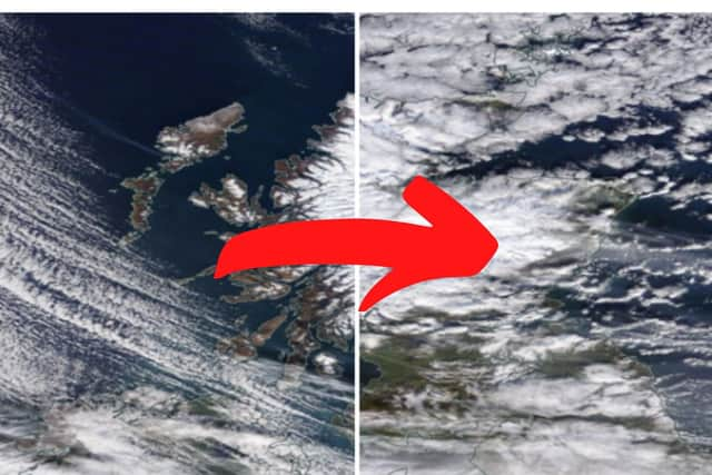

It comes as The Met Office’s station in Braemar, Aberdeenshire, recorded a temperature of minus 23C on Wednesday night, the lowest in the UK since 1995.
Now you can explore the weather from above with our interactive comparison slider map comparing images from January 30 to February 11.
The pictures are available from Nasa’s Worldview project, which allows users to explore earth from their satellite's perspective.
Nasa (National Aeronautics and Space Administration) is an independent agency of the U.S. government.
A message from the Editor:
Thank you for reading this article. We're more reliant on your support than ever as the shift in consumer habits brought about by Coronavirus impacts our advertisers.
If you haven't already, please consider supporting our trusted, fact-checked journalism by taking out a digital subscription.
Comments
Want to join the conversation? Please or to comment on this article.