Scotland's weather: Snow threat to tomorrow's rush hour


The Met Office issued a yellow – “be aware” – alert for snow and ice for the whole country apart from the North-east, Caithness and the Northern Isles until 10am.
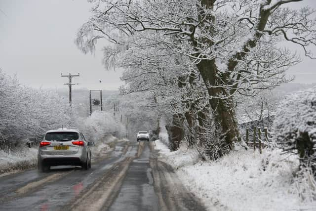
The agency warned of potential travel disruption and difficult driving conditions.
Advertisement
Hide AdAdvertisement
Hide AdHowever, it said Storm Jake, which was named earlier today by Met Eireann, the Irish national meteorological service, would only affect Ireland.
This winter’s joint storm naming initiative with the Met Office means both organisations have to recognise each one even if it only affects part of the British Isles.
Stuart Brooks, a forecaster with the Met Office in Aberdeen, said: “While the North-east will have minimal impacts, there’s a decent threat of snow cover elsewhere overnight.”
A Met Office spokeswoman added: “Showers will turn wintry this evening across the warning area, with the risk of a more prolonged spell of snowfall late in the night and early Wednesday morning, especially in the south.
“This will give a covering of snow with 2-5cm possible in many places and locally 5-10cm, these higher accumulations mainly above 100m.
“Icy stretches on untreated roads and pavements are also likely to form.
“Please be aware of some difficult driving conditions and the potential for travel disruption into the Wednesday morning rush hour.”
The Met Office said the snowstorm would be caused by a cold front moving east and south, bringing “significantly colder air with frequent showers”.
Advertisement
Hide AdAdvertisement
Hide AdMr Brooks said possible further snow may follow on Friday, but it was likely to be mainly over higher ground.
He said: “It will stay fairly cold for the rest of the week and into the weekend.
“We are watching a weather system on Friday which could bring significant snow to Wales and central England, with the potential to spread further north.”
Today was the official start of spring but the more traditional date is the vernal or spring equinox, on 20 March, after which nights become shorter than days.
Strong winds forced the cancellation of some west coast ferry sailings yesterday.
South of the Border, blustery weather is expected this morning across south-west Wales and south-west England, where isolated gusts of 70mph are possible around exposed coasts and gusts of 50mph inland.