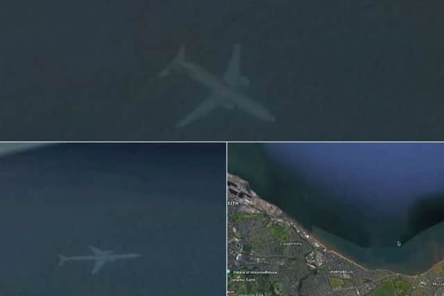
Mystery of Google Maps '˜underwater plane' near Edinburgh solved


Yesterday we reported that eagle-eyed Robert Morton had spotted what appeared to be a plane underwater on Google Maps.
He said “I was just looking on Google Earth on Monday and, by chance, I came across the picture of the aircraft.
Advertisement
Hide AdAdvertisement
Hide Ad“It looks like it is the sea, just off the coast of Edinburgh. It looks like it is underwater.”

However, it would appear that the discovery was not the first time that a plane has been spotted apparently underwater on Google Maps.
In 2015, a similar sighting was spotted beneath the waters of Lake Harriet in Minneapolis, and it would appear that there is a rather simply explanation.
A Google Maps spokesperson explained: “In short, each satellite image you see on the map is actually a compilation of several images.
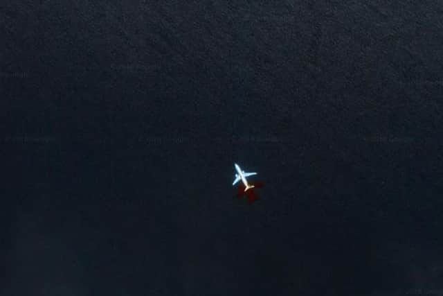
“Fast-moving objects like planes often show up in only one of the many image we use for a given area.”
As a result of the speed of the plane, and Google Maps stitching numerous images together, the plane appears to be underwater as the plane has not been properly captured on any one image.
According to Google experts, areas of constant flight activity are more likely for such images to appear on Maps.
Google have been quick to rectify the underwater plane near Portobello beach adding in colour and texture to the plane showing it is clearly above ground.