Apple maps fail to show new Queensferry Crossing route


While Google Maps and many other sat nav providers have been quick to update their service to reflect the new crossing, navigation on the Iphone still suggests users take the Forth Road Bridge.
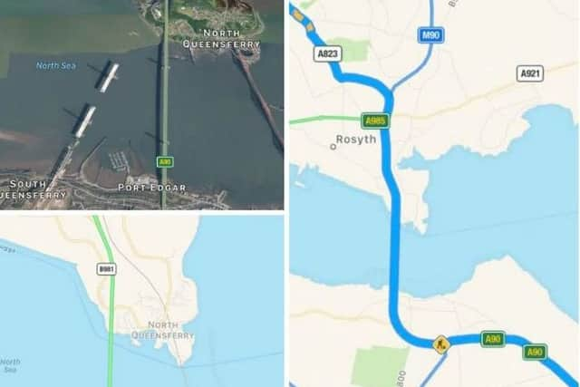
A satellite image of the crossing also only shows the partially completed bridge, which officially opened yesterday.
Advertisement
Hide AdAdvertisement
Hide AdAs part of the opening the Forth Road Bridge is closed as work is carried out to make it a public transport carriageway, however Iphone maps still shows it as open.
Bill Barclay wrote on social media: @AppleSupport hi there, wondering why maps on my iPhone are not updated regarding the new Queensferry Crossing over River Forth? New roads?
Apple responded stating that: “We appreciate you taking the time to report this to us. We hope to get that updated soon in the future.”
There is a new road layout in place as part of the crossing development, with many users expressing difficulties if their maps are not updated.
From 1 to 6 September all traffic will use the Forth Road Bridge, utilising the same routes as before the opening of the new crossing.
After the Queensferry Crossing re-opens on September 7, the Forth Road Bridge will remain open to cyclists and pedestrians only.
The record-breaking construction saw 23,000 miles of cable used, nearly enough to circle the globe if laid end to end.