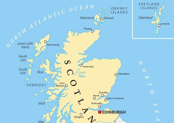
Leader comment: Maps can make us see Scotland and the world differently


In the eyes of some, this is a political snub; view the Gall-Peters projection, which better reflects size by making different compromises, and you will see the world in a different way.
Putting Shetland in a “box” off the north-east coast on maps of Scotland appears a practical thing to do. It is far enough away from the north coast that showing its true position would require making the mainland much smaller or the map considerably bigger.
Advertisement
Hide AdAdvertisement
Hide AdBut some, like the island’s MSP, Tavish Scott, see this as a political snub, demonstrating the islands are an “afterthought” in the Scottish Government’s thinking.
If this view is held by many on the islands, it seems sensible to find a compromise, perhaps by using official maps showing the true position alongside more practical ones.
It might benefit everyone – and do no harm – to see how far Shetland is from the mainland and to see Scotland in a different way.