Richard Lilley: Help us put seagrass meadows on the map


With all this on our doorstep, we have every right to feel fortunate. We have a rich and diverse seafood sector. However, it wasn’t always this way. In fact, truth be told, it was better. In Scotland (as is the case globally) marine habitat loss is widespread. Last year we sadly witnessed damage to a rare flame shell reef in Loch Carron, while at the same time, our seas are now having to deal with the large-scale impacts associated with climate change and widespread pollution.
However, we must not despair, rather we must work together to find solutions and bring to the public consciousness a sense of optimism for the future of our blue planet. Many leaders are now seeking the support of passionate and committed citizens to map the important marine habitats that support our fisheries, and to provide the vital data that can support their effective management.
Advertisement
Hide AdAdvertisement
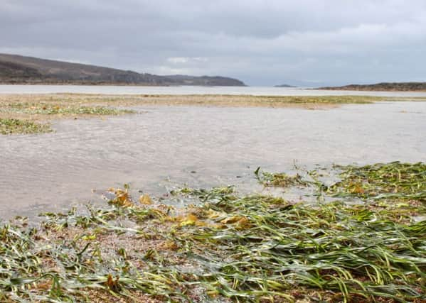
Hide AdOne such habitat is seagrass. Seagrasses are flowering plants that live in shallow, sheltered areas along our coast. These sensitive plants are different from seaweed and show bright green leaves. These leaves form large, dense meadows under the sea like underwater gardens full of life. Research last week has confirmed the value of these meadows in supporting world fisheries production and thus the pressing need to put more effort into their conservation.
There is no easier way for people around the world to help protect seagrass than by getting involved with the collection of information about this precious resource. Understanding where seagrass is and mapping its distribution is an important part of conserving it and preventing its loss. To date, the world has mapped around 300,000 km2 of seagrass, yet experts have speculated that there could be up to 4 million km2 of seagrass – all of which needs mapping.
To celebrate World Oceans Day, Project Seagrass, a marine charity, has released a global version of the smartphone app SeagrassSpotter and is encouraging people to take part in this Citizen Science project. Both the website and phone app allow people from all around the world to help scientists understand and conserve globally important seagrass meadows.
In Scotland, our “Call to Action” is immediate. It is hoped that any data collected this summer will be able to directly inform the future management of Scotland’s seagrass meadows in the autumn, especially since seagrass has already been identified as one of 11 of the most vulnerable Priority Marine Features by the Scottish Government.
This updated version of SeagrassSpotter.org includes the first easy-to-use identification guide for seagrasses. Simply put, a user can take a photo of intertidal seagrass using the app, or, for other devices, people can simply upload a picture taken with any camera direct to the website. The user will then be asked to identify and describe what they’ve seen using a simple key.
People in Scotland can use it any time, for example while out walking the dog or when out snorkelling or scuba diving with friends. Alternatively, you can now use it while on holiday anywhere.
To date Seagrass Spotter has collected over 1,000 records of seagrass around Scotland and northern Europe; but at Project Seagrass we now hope to make this success global. We hope to obtain hundreds of thousands of records by engaging people from all around the world to collect data about seagrass in their locality.
With more data we can provide the evidence needed to support seagrass zones, special areas of the seabed that can be officially recognised and protected from threats. There is a rapid global decline in seagrass and when seagrass is lost there is strong evidence globally that fisheries and their stocks can become compromised with profound negative economic consequences.
Dr Richard Lilley is a marine biologist and founding director at Project Seagrass, www.SeagrassSpotter.org