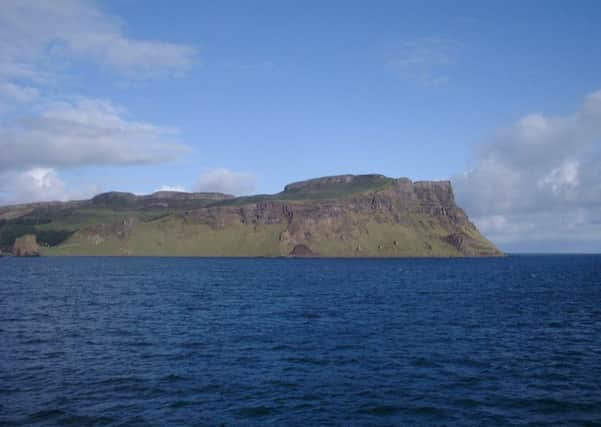
Walk of the Week: Isle of Canna


Not long into the voyage, a lady realised the ferry was not going to Skye. To our amazement, and solely for her benefit, the captain returned to Mallaig. Many go to Canna on an eight-hour Saturday visit. Despite its modest size, five miles long and 1½ miles wide, even our three-day stay at the very comfortable Tighard Guest House was insufficient to explore the whole of the island.
Lime-rich basalt lava flows have given the island not only its distinctive terraced topography but also unusually fertile soil and abundant plant life, and Canna’s cliffs make the perfect home for seabirds and birds of prey.
Advertisement
Hide AdAdvertisement
Hide AdIn 1821, 436 people lived on Canna and Sanday, but within 40 years, following emigration (willingly or forcibly) to the New World, that number had declined to 127. John Lorne Campbell, an eminent Gaelic scholar, bought Canna in 1938, managed it as a working farm and nature reserve, then gifted the island to the National Trust for Scotland in 1981. Now there are just a couple of dozen or so residents. The best way forward for the island and its people is the subject of much debate.
The island, with its unlocked Community Shop and an honesty box, became a story for the world’s press with this year’s looting. The abuse of the honesty system resulted in support, and donations large and small, from all over the world.
MAP Ordnance Survey map 39, Rhum & Eigg
DISTANCE 6 miles
HEIGHT 300m
TERRAIN Track to grassy but craggy terraced hillside
START POINT Canna pier, map ref 278051
TIME 3 to 4 hours
NEAREST TOWN Mallaig
REFRESHMENT SPOT Café Canna, open April to 2 October inclusive
THE ROUTE
A walk to a souterrain, then to the highest point, 210m/689ft Carn a’Ghaill, is best done in a clockwise direction on a clear day – otherwise the souterrain will be hard to find.
In thick mist a straight line compass approach will not cope with the many rocky undulations.
Follow the “road” from the pier, pass the shop and café (the latter open to 2 October, so go soon!), then branch right as signed (a pink circle with a black arrow) to the camp site, rather than crossing onto Sanday. The “road”, by now close beneath the impressive columnar basalt cliffs, gives a superb coastal stroll. On our clear day we could see the 5-mile distant white lighthouse on Oigh-sgeir.
A rise then a short dip leads to a hairpin bend. Turn right (north) to leave the “road” (as signed on a wooden block) and follow a rough then grassy way with periodic signs. Later turn right as signed to cross a drystane dyke. A few yards beyond is a grassy mound and the almost hidden souterrain; an enigmatic 2,000-year-old underground chamber with two narrow entrances; an adult can enter the first, but perhaps not the second.
Head eastwards to 180m Beinn Tighe, which gives good views west to the Uists. Descend NE (left) to a line of fence posts above the dramatic north coast cliffs, then east to the circular concrete trig point on Carn a’Ghaill, rocky hill of the storm; a Marilyn, hills of any height but with a drop of at least 150m all round.
Advertisement
Hide AdAdvertisement
Hide AdDescend east to another line of fence posts, netted and barbed, followed southwards to a gate. (A short detour to Compass Hill, named because the large amount of iron in it affects compasses, may be of interest. The compass needle really does move.) Go SW by the edge of the mapped wood to reach a metal gate by Tighard, from where a charming zigzag path leads back to the shop.