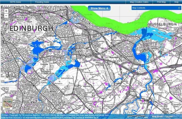
Maps of Scotland’s flood-risk communities issued


The maps, produced by the Scottish Environment Protection Agency (Sepa) yesterday, highlight the places where homes and businesses are most vulnerable to rising water levels and tidal surges.
The maps are the most in-depth national source of information on flood risk, showing different types of flooding, the likelihood of it happening and the impact of encroaching water when it does occur.
Advertisement
Hide AdAdvertisement
Hide AdIt’s hoped the new information will increase understanding of the sources and impacts of flooding and provide a key tool in creating Scotland’s first ever co-ordinated plans to tackle the problem.
Scottish environment and climate change minister Paul Wheelhouse said the increasing frequency of the sort of severe weather the country has recently been experiencing means such preparation is crucial.
He said: ”SEPA’s new flood risk and hazard maps are an extremely useful tool in supporting flood risk strategies across Scotland as they show not only the extent of flooding under different risk scenarios, but also the potential depth and velocity of flood waters.
“With extreme weather events predicted to become more frequent, it is of the utmost importance that we are as prepared as possible to respond when these hit.”
James Curran, chief executive of SEPA, said: “It is clear that there has never been a greater need for this information, as we have seen, yet again over the last month, the misery that flooding has brought to communities across the country.
“As many people will be all too aware, flooding is a real threat and it can have devastating effects on lives and properties. In Scotland, for many years now, we’ve been aware of the expected increase in flooding caused by climate change and by having more information on the types of flooding and its impacts we can make more informed decisions and target our resources in the areas where we can make a real difference.
“We can all help to reduce the impacts of flooding. By taking action now members of the public and businesses can limit the damage which flooding can cause.”
The new national map, which builds on information available in the agency’s previous Indicative River and Coastal Flood Map, includes details on the depth and speed of torrents where available.
Advertisement
Hide AdAdvertisement
Hide AdAnother new map created by the agency identifies areas where natural defences could be utilised to protect against flooding. It was developed as part of plans for a more sustainable approach to tackling flooding in Scotland, and highlights areas where natural features and the shape of the land could help reduce the likelihood and effects of rising waters.
Working closely with local authorities and Scottish Water, environmental protection officers will use the new charts to produce co-ordinated flood risk strategies and local management plans that consider whole river catchments and coastlines and identify actions needed to combat flooding in Scotland.
“A huge amount of work has gone into the creation of these maps and their launch comes as a result of successful partnership working between the Scottish Government, SEPA, local authorities and Scottish Water. This tool will help us to better understand the nature of flood risks at a local level and thereby to target efforts to plan and invest in mitigating potential flooding impacts in vulnerable areas,” said Mr Wheelhouse.
The new approach has been driven by the Flood Risk Management (Scotland) Act (FRM Act), which recommends a joined-up approach to effectively tackle the issue.
Mr Curran added: ”The publication of new flood maps is a key milestone of the FRM Act, and will help us and our partners to take a more co-ordinated, sustainable and targeted approach towards reducing the impacts which flooding can have.”
SEPA’s Floodline service provides advance flood warnings for more than 250 areas across Scotland and people can sign up to receive warnings direct to their phone.