Archaeologists put in the picture about Borders' past by heatwave


That’s because heatwaves such as the one that has seen the Borders bask in Mediterranean-like temperatures over recent weeks dry out soil and make underground sites dating back to prehistoric times more visible.
Crop marks showing ancient settlements and Roman fortifications usually hidden beneath farmland can now be spotted from the air more easily and are being documented on film by Historic Environment Scotland.
Advertisement
Hide AdAdvertisement
Hide AdSites newly revealed by the heritage body’s aerial survey team during the recent warm weather now coming to an end include an Iron Age souterrain, a rare find for this neck of the woods, and a Roman temporary camp.
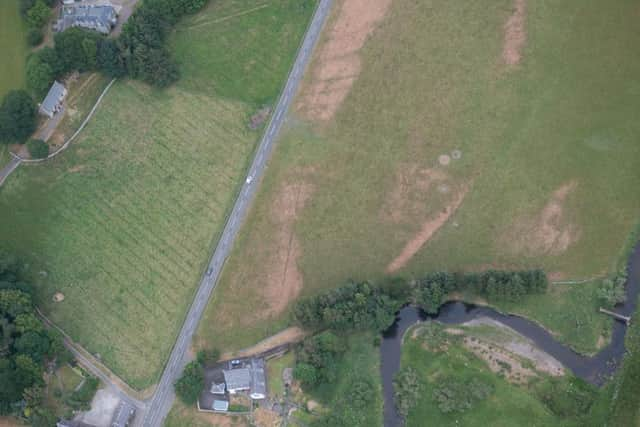
The camp was spotted within the already-known complex of Roman sites at Lyne, near Peebles.
Its discovery takes the tally of forts known to be there to five, two of them long-term and two temporary.
The newly-sighted souterrain, an underground chamber, is also near Peebles, by the Eddleston Water.
What is thought to be an Iron Age fort has also been sighted near Selkirk.
The marks now being mapped out from above form as crops respond to dry conditions and allow the team to document known sites not visible for many years as well as adding new ones to its records.
Iron Age burials, Neolithic pits and prehistoric settlements are all marked out more clearly in fields for now, as are long-dry rivers and streams, revealing how the landscape of the Borders has changed over the centuries.
Dave Cowley, aerial survey project manager at Historic Environment Scotland, said: “Aerial surveys of Scotland have been carried out since the 1930s, with each year usually adding a little more to the patchwork of our knowledge.
Advertisement
Hide AdAdvertisement
Hide Ad“We depend on dry years to bring out the buried remains in the crops, so we are currently out hunting for new clues from the skies while the good weather lasts.
“The conditions this year are showing us many sites that we knew were there but may not have been seen in recent damp summers, as well as revealing new archaeological sites that add to our ability to see into the past to tell Scotland’s story.”
The aerial survey team scour Scotland from the sky to record its historic environment, and it has discovered and made note of more than 9,000 buried sites to date.
For further details, visit www.historicenvironment.scot/about-us/what-we-do/survey-and-recording/aerial-survey