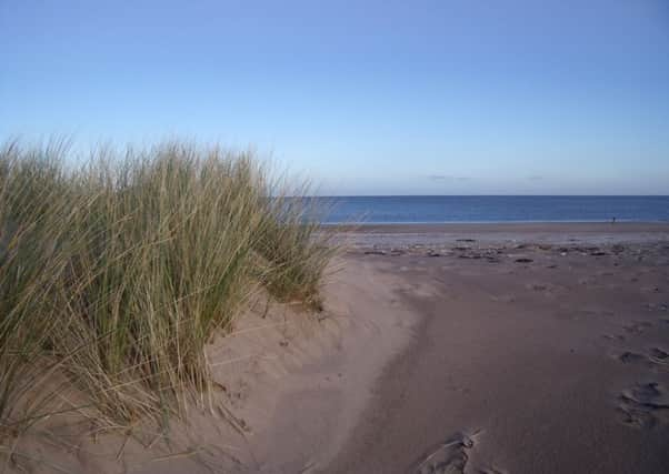
Walk of the Week: Tentsmuir Point, Fife


But what really makes this place beautiful for me is the stretch of sandy beach you can walk along to reach it, backed by a thick forest.
In summer the car park is thronged and the beach near it a sea of towels and picnics. In winter it is less busy, allowing a greater sense of space and the ability to stroll out with only the odd bird spotter or dog walker along the way.
Advertisement
Hide AdAdvertisement
Hide AdIt is worth checking the tide times (www.bbc.co.uk/weather/coast_and_sea/tide_tables) before setting off as parts of the route can be submerged.
DISTANCE 6 miles.
HEIGHT CLIMBED Negligible.
TIME 2 1/2 to 3 1/2 hours.
MAP OS Landranger 59.
PARK Follow brown signs for “Tentsmuir Forest and Beach” out of Leuchars and down narrow lanes to a car park. £2 charge.
IN SUMMARY Leave the car park at the top right-hand corner and head straight ahead, through sand dunes. You emerge on Tentsmuir Sands – a wonderful stretch of beach where you should turn left. Follow the line of dunes north with views of Angus ahead and St Andrews behind.
After about a mile and a half the dunes end and you should go left to reach a tidal stretch of sand. Follow the back of the dunes in the opposite direction from where you have come for a few hundred yards, until it is safe to cross over the sand towards the forest. (Take care to avoid the water as even when it is shallow it can flow fast enough to knock people off their feet.)
Once on a path in front of Tentsmuir Forest go right to walk up to a pedestrian gate and on the other side of this continue in the same direction. The path follows marker posts with shells on them behind the dunes and on to a green, corrugated iron hut on concrete and brick legs.
Leave the path at this point and follow the beach, from where there is a good chance of spotting seals – don’t approach them, especially if you have dogs with you. If the tide is high, or coming in, you may have to walk on top of the dunes.
Eventually the Firth of Tay signals you can go no further and have reached Tentsmuir Point. Go left and head for the corner of the forest. Above a fence running across the beach is an information board with a stile beyond. Cross this and walk towards the trees where you will find a grass track running in front of them. Go left and follow the track to a large gate on the left – where you go right, into the forest.
A short way along the track go left at a junction then go straight ahead at the next junction. The track passes an old, turf-roofed ice house and continues all the way back to the car park.
Advertisement
Hide AdAdvertisement
Hide AdREFRESH As there is nothing at the start of the walk, it is best to head for St Andrews.
WHILE YOU ARE IN THE AREA St Andrews with its golf courses, cathedral and beaches is nearby. Or try the Scottish Deer Centre just before Cupar, if going west on the A91 (www.tsdc.co.uk).