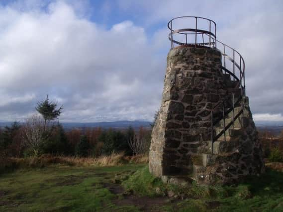
Walk of the week: Tyrebagger Hill, Kirkhill Forest, near Aberdeen


Although marked as Tyrebagger Hill on OS Maps, it is called Tappie Tower by the Forestry Commission, after the 19th century folly on top. It was built by Dr William Henderson in 1875 to either commemorate the first visit of Queen Victoria to Aberdeen or simply show how high his land extended, depending on which version of history you prefer.
Whatever the reason for the construction, it epitomises the Victorian trait of building things on top of hills and mountains. Ben Lawers in Perthshire was also subjected to this idea – in its case a cairn (which ultimately collapsed) was built to try to make it 4,000ft in height, rather than the 3,983ft created by nature.
Advertisement
Hide AdAdvertisement
Hide AdOn top of the folly, or at its base, the views are great. North-west lies the pointed top of Bennachie, while to the east lies the North Sea, with the many vessels frequenting Aberdeen harbour catching the eye. All around, the rolling countryside of Aberdeenshire makes this a pleasant place to linger.
DISTANCE 3∫ miles.
HEIGHT CLIMBED 360ft.
TIME 2 hours.
MAP OS Landranger 38.
PARK The Mountjoy Car Park is in the Forestry Commission’s Kirkhill Forest, on the north side of the A96. About four miles west of the A90 in Aberdeen turn right, off the A96, just before the junction with the B979 Kirkton of Skene road.
IN SUMMARY Follow the track at the end of the car park, into forest. After a few hundred yards stay on the main track at a marker post, following a white arrow. The track goes round to the right then twists uphill.
Higher up, the track turns sharp right before following a more level gradient. Eventually, the main track doubles back on itself in a wide, uphill turn to the left. Another fairly level section leads to a right-hand bend (ignore a path to the left). A junction is reached soon after the bend, where you should go left.
The track reaches a marker post indicating a path to the left, back down to the car park, but you should go straight on. About 150 yards after the marker post, go right at another one (signed for Tappie Tower) and follow a path over open hillside to the folly at the top.
After enjoying the view return to the track and go back down to the path signed for the car park (passed earlier). The path drops down and turns left to pass along the top of a field before swinging right. Keep straight on at some beech trees to continue downhill.
Lower down, the path swings left then continues for about half a mile to reach a track coming up from the right. Go left to walk the short distance up to the track followed earlier and turn right to retrace your steps the last few hundred yards back to the start.
REFRESH There is nothing at the start of the walk – Aberdeen is your best bet.
Advertisement
Hide AdAdvertisement
Hide AdWHILE YOU ARE IN THE AREA The Maritime Museum in Aberdeen is well worth a visit. It includes a huge model of an oil rig as well as the history of the large harbour below it. www.aagm.co.uk/Visit/AberdeenMaritimeMuseum