Walk of the week: The Pentland Way


The Pentland Way, a well-signed 20-mile route from Dunsyre to Swanston, follows a variety of long-established tracks and paths. The Friends of the Pentlands, www.pentlandfriends.org.uk, who seek to promote the conservation, protection and enhancement of the Pentlands, have been responsible for several publications. The most recent, and highly recommended, is The Pentland Way, A Walk with History by Bob Paterson.
The book, which brings to life much that may be invisible to casual walkers, would make an ideal Christmas gift. To order copies contact John Stirling at j.stirling@btinternet.com or on 0131-449 3456.
Advertisement
Hide AdAdvertisement
Hide AdGiven the lack of public transport and suitable parking (and alas, nowadays, no train), arguably Dunsyre is not the ideal start. Walkers could arrange to be dropped off at Dunsyre or, alternatively, start from Dolphinton, which is on a bus route.
Christine, the Mountain Maid and Hare and I facilitated our car-free linear stroll from Dunsyre to West Linton by using the frequent Stagecoach bus service (phone Traveline 0871-200-2233) on the A702. Services 101 and 102 pass through West Linton and Dolphinton, albeit we then had a minor road walk to get to Dunsyre.
Map Ordnance Survey map 72, Upper Clyde Valley
Distance 8 miles
Height 150m
Terrain Minor road, path and track
Start point Dolphinton
Time 3 to 4 hours
Nearest village West Linton
Refreshment spot Olde Toll Tea House, Main Street, West Linton
Alight at Dolphinton’s southern bus stop by the road sign, 2¾ miles to Dunsyre. The quiet road passes by Blackmount parish church, rises around White Hill, then gently descends to Dunsyre. Pass under the once bridge that carried the old railway line, then immediately turn right for the start of the Pentland Way by Dunsyre Mains, also signed public footpath to Garvald 1¾ miles and West Linton 5½ miles.
On the right is The Halt, the old stationhouse though now much altered and extended. Beside the track to Dunsyre House is the still-obvious platform. Later on, a lengthy stretch of the grassy embankment is seen from the Tarmac road. When the road turns left to Easton Farm, continue in a straight line, by now on a track. When the track reaches a ford across the Medwin Water, follow the signed path on the left to cross upstream by a footbridge. Pass by the public footpath to Crosswood via the Covenanters’ grave and a few yards later slant right as signed and descend by grassy path to the Medwin Water, spanned by a wooden bridge.
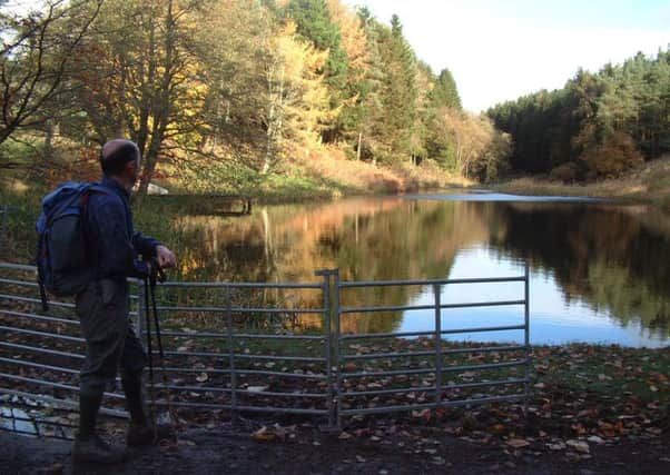
Follow the marked route by the north side of Garvald and note the sign for West Linton. Continue to Ferniehaugh, keeping straight ahead where the road splits, to reach the charming pond, beautifully maintained by the owner at Ferniehaugh. Keep the pond on your right and continue in a straight line, then by track by the edge of a plantation. Traverse north-east across a moor, its bleakness relieved by the moorland birds and remnants of prehistoric burial cairns. The track reaches the high point at what is known as the Garral, an 18th-century focal point for outlawed gatherings of Covenanters, and passes the source of the Garvald Burn, the Rumbling Well, unremarkable other than for being part of Scotland’s west/east watershed.
The way becomes a broad smooth track, descending past a small quarry on the left. Reach the West Water reservoir road and continue in a straight line, by now on a Tarmac road which runs through West Linton golf course. Just beyond the clubhouse is a T-junction. Leave the Way, turn right and descend for ½ mile to the A702 and the bus stop opposite the Gordon Arms Hotel.