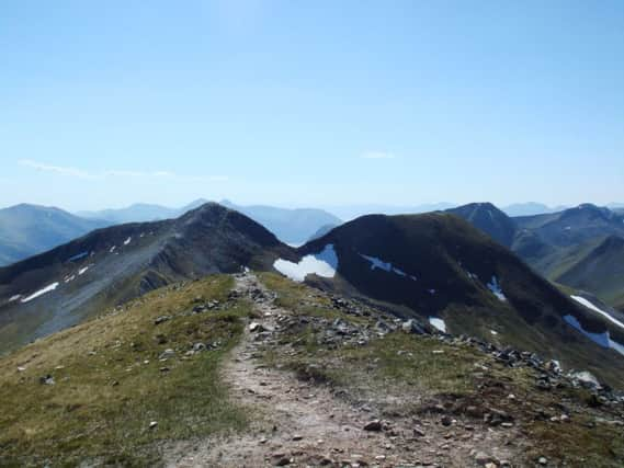
Walk of the week: Na Gruagaichean


Built in the early 1900s, the old aluminium smelter, powered by water from the Blackwater dam, transformed the then handful of houses into a small and unattractive village where law and order were more akin to the Wild West. My great-grandfather, a manager during the smelter’s construction, was authorised to carry a gun. Kinlochleven now boasts the world’s largest indoor ice wall, situated in the Ice Factor, a worthy renovation of part of the smelter complex. Changed days. (Unfortunately, due to a fire, Ice Factor is closed until further notice.)
Na Gruagaichean is invariably climbed from Kinlochleven, with the sea-level start eased by the track that climbs to Mamore Lodge and from where a stalkers’ path gives a gradual albeit long approach to the summit.
Advertisement
Hide AdAdvertisement
Hide AdThanks to its nearby and marginally lower subsidiary Top, Na Gruagaichean has a twin-peaked appearance, so it is no surprise that the name means the maidens, although I would have thought that maiden singular (its former name, a’Gruagach) would have been a better description. The cleavage has a dip of 46m from the Top.
It can be argued that Na Gruagaichean scarcely justifies its Munro status (a modest 98m ascent and short distance from its eastern neighbour), yet only a philistine could suggest its almost symmetrical and prominent summit, a marvellous viewpoint, is not worthy of a visit.
Map Ordnance Survey map 41, Ben Nevis, Fort William & Glen Coe
Distance 10 miles
Height 1,100m
Terrain West Highland Way path to track then stalkers’ path to stony summit
Start point Grey Mare’s Tail car park, Kinlochleven, map ref 188623
Time 6 hours
Nearest village Kinlochleven
Refreshment spot MacDonald Hotel bothy bar, Kinlochleven
THE ROUTE
From the Grey Mare’s Tail car park, map ref 188623, head west by pavement by the B863 to join the West Highland Way path. This slants right, passing through woodland to meet the private tarmac road and so to the now-closed Mamore Lodge at a height of 200m. (It used to be possible to drive to the lodge, but a sign at the roadside makes it quite clear that the gate may be closed at any time.)
From the lodge, go NE along the track for half a mile to the bridge over the Allt Coire na Ba. Head north, at first by track then stalkers’ path, into the open corrie, climbing steadily and easily by the east bank of the stream. Much of this lower section is getting overgrown and, on my admittedly very wet day, the path was vague in places and muddy.
However, nearing the headwall, the path, with its well-constructed zigzags and graded slopes, really comes into its own as it goes on an enormous eastward dogleg (and even south for a bit) before heading NW to reach the Mamore ridge at a height of 783m.
Advertisement
Hide AdAdvertisement
Hide AdHead SE on the grassy ridge, a climb of some 250m, following the worn path to reach the small rounded grassy pap of the subsidiary Top – on a misty day not to be taken as the summit. Descend carefully SE on surprisingly steep ground. With steep rocky ascents in both directions, loose and eroded in places and crags on the NE side, the traverse needs care. Under icy conditions, caution is required. Then climb steeply to the very rough and stony summit.
(The Top can be avoided to the SE, to reach just south of the Munro, but one cannot then say that the maidens have been climbed.)
On return into the corrie, it is easier to cut out parts of the dogleg. However, for the most direct return to Mamore Lodge, given good conditions, follow the short southern stony spur then the steep but grassier ill-defined SW ridge. n