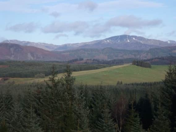
Walk of the week: High Corrie, Loch Ard Forest, Trossachs


On arriving my mood immediately changed, with views to the hills and mountains of the Trossachs being brought into full Technicolor by low winter sunshine. The High Corrie trail, laid out on established tracks by the Forestry Commission, is basic (no paths have been built) but it does allow walkers to stride out. There are also plenty of clearings which make this walk worth doing as views open out in all directions, including over the Carse of Stirling with the Ochil and Gargunnock Hills on either side.
Most of the route is waymarked by posts with blue flashes on them (one was missing at a junction, but I luckily guessed correctly and turned left). Missing posts are one reason some people don’t like waymarked routes because, they say, people can go astray when they should be able to route find without indicators. However, in my experience the posts are usually all in place and they offer reassurance to those who might otherwise feel wary about going out into the hills and countryside.
Advertisement
Hide AdAdvertisement
Hide AdSo enjoy this walk. Even if it is not over “wild” land and follows tracks, it is a good way of getting out in winter, and the views are great.
DISTANCE 5∫ miles.
HEIGHT CLIMBED 420ft.
TIME 2 to 3 hours.
MAP OS Landranger 57.
PARK Turn off the A81 a couple of miles south of Aberfoyle, following a sign for Gartmore. At the end of the village turn right and then go right at a junction. About one-and-a-half miles further on there is a Forestry Commission car park on the left, just after a large stone house.
IN SUMMARY Cross over the road at the entrance to the car park then, at a fork, take a track going up to the left. Once through a metal gate at a turning area go left at another fork. The track leads up to a junction (where you go straight on) and then a cleared area with views to the Menteith Hills and Ben Ledi beyond. At another clearing Ben Lomond comes into view ahead. At the end of this clearing go sharp right at a junction to begin the return.
The track drops down, eventually reaching a junction where you go left. Drop down for a couple of hundred yards and take a rough track on the right, going downhill in a straight line.
At the bottom go right to follow a minor road all the way back to the road junction at the car park entrance.
REFRESH There is a good choice in both Drymen and Aberfoyle.
WHILE YOU ARE IN THE AREA At the Lodge Forest Visitor Centre above Aberfoyle is a Go Ape with rope bridges, Tarzan swings and a zip slide (www.goape.co.uk), while the Glengoyne distillery down the A81 south of Killearn is a good stop-off for tours and tastings (www.glengoyne.com).