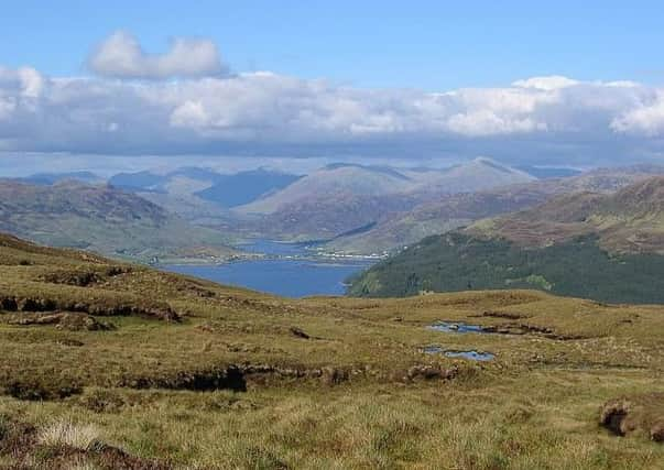
Walk of the week: Glas Bheinn


James Hogg, on his Highland Tours in the early 1800s, commented on the Glen Shiel district. “The mountains are very high and steep, especially those of them most contiguous to the sea. The snow never continues long – the frosts are seldom intense, but the winds and rains are frequent and terrible.” With regard to the latter, that weather pattern remains true today. Nevertheless, even on a poor weather day the district offers a choice of lower level walks. Rhona was particularly interested in climbing 394m Glas Bheinn, classified as a Marilyn, hills of any height but with a drop of at least 150m all round. The hill lies amid a ten-mile clockwise route; a beautiful coastal walk to Ardintoul then by track to Bealach Luachrach, and on to the hill, followed by a track descent to Glenelg Bay. I was happy to accompany Rhona on the short detour to the hill.
Map Ordnance Survey map 33, Loch Alsh, Glen Shiel & Loch Hourn
Distance 10 miles
Height 450m
Terrain Track and path, then tussocky climb to hill
Advertisement
Hide AdAdvertisement
Hide AdStart point Glenelg ferry car park, Kyle Rhea, map ref 795213
Time 5 hours
Nearest village Glenelg
Refreshment spot Kintail Lodge Hotel, Glenshiel Bridge
THE ROUTE
Drive over Mam Ratagain, cloud enshrouded on our day, to reach the Glenelg ferry crossing to Skye at Kylerhea. The ferry car park is the start of the partially waymarked Lochalsh Trail (a green circle with a white boot) and identified by the roadside green sign – Ceum Path (ceum is Gaelic for footpath), Ardintoul Bay 5.7k (3½ miles).
Follow the lovely grassy track which later descends to go parallel to and overlooking Kyle Rhea, known for its swirling tide-race, and pass by the Kylerhea Otter Haven on the far shore. Then at a signposted junction turn left and go under one very high electricity pylon, at odds with the wild landscape. The track becomes a narrow scenic path overlooking the shore line, crossing side streams and passing by silver birches -– surely one of the best coastal walks in the country.
The path descends to the shingly shore by Loch Alsh, later on the landward side of a drystane dyke on the pasture area before Ardintoul Point. Then turn right on the mapped path, in fact a grassy track. In the distance to the left are earth banks and a perimeter fence, from a Second World War Royal Navy oil fuel depot.
The grassy track leads to a broad gravel track. Turn left and pass by the remains of Ardintoul House, destroyed by fire in 2012. The remote estate house was built in the 1700s for the MacRae family at about the time of the destruction of their hereditary stronghold, Eilean Donan Castle.
Continue to Ardintoul Bay, turn right on the shore then head inland (south) to pass more ruins, evidence of a once bigger township. The partly Tarmac track (surfaced for the construction of the fuel depot?) climbs steeply uphill. Later the track, a mixture of gravel and Tarmac, easily leads to 238m Bealach Luachrach. Time for the hill.
It is rough going by the edge of the felled area, following the line of old dyke and metal fence posts, to reach the tussocky SE ridge. As with other hills, the summit trig point adds an air of authority – unjustified in this case. We enjoyed a pleasant rest until the heavens opened and any thought of visiting a bump to the north was quickly abandoned. Oh dear. It was only on getting home that Rhona realised that the bump is 3m higher and hence the Marilyn point. She can go back on her own!
It is a zigzag but quick track descent into Glen Bernera, where most of the lower slopes have been felled, then the pleasing one-mile road return to the car park. Given the weather, not surprisingly we had met not a soul all day.