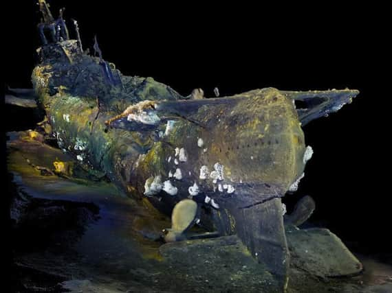
Aberdeen firm’s ‘pioneering’ tech maps lost WWII submarines


Viewport3, which provides underwater 3D scanning and engineering services using remotely operated vehicles or diver-mounted cameras, has joined forces with explorer Tim Taylor to find and map sunken war vessels.
The firm teamed up with Taylor’s Lost 52 project, which is responsible for the discovery and mapping of four of the eight lost US Second World War submarines located to date.
To support the project, Viewport3 co-director Chris Harvey developed several new methods of using digital imagery, which also have applications in industries such as the oil and gas sector.
Taylor, chief executive of New York’s Tiburon Subsea Services and founder of not-for-profit marine organisation Ocean Outreach, described Viewport3’s work as “revolutionary”, as it processed 3D scans on the bow and stern of USS Grunion, a submarine which was lost in October 1942.
The project last year mapped and filmed the site of the vessel, finding its missing bow section a quarter of a mile from the main wreckage, off the Alaskan island of Kiska. Assumed lost with all hands, the Grunion is thought to be the final resting place of 70 sailors.
Viewport3 has worked on the Lost 52 project for more than four months, processing 25 hours of HD video frame by frame.
Harvey said: “Using our photogrammetry technology as a digital in-situ preservation technique offers numerous benefits – non-destructive inspection of the site, optimal resource management and an inexpensive capture technique compared to other 3D recording technologies.
“We can capture precise, technical-grade results which produce visually correct outputs, whether we are working in archaeology or with operators and marine contractors in the oil and gas industry.
“The work that Mr Taylor is conducting, coupled with our technology and expertise, is making a wealth of information available across different industries and opening the door on discovery and expeditions at these unique locations.”
Taylor added: “Viewport3’s approach extracts geometric information from equipment that is already integrated in most of the modern underwater remote filming systems. It is revolutionary.
“Spending a short time on site collecting a comprehensive 3D historical baseline model allows archaeologists and historians to spend months in the lab performing detailed archaeological work. This truly is the future of underwater archaeology. ”