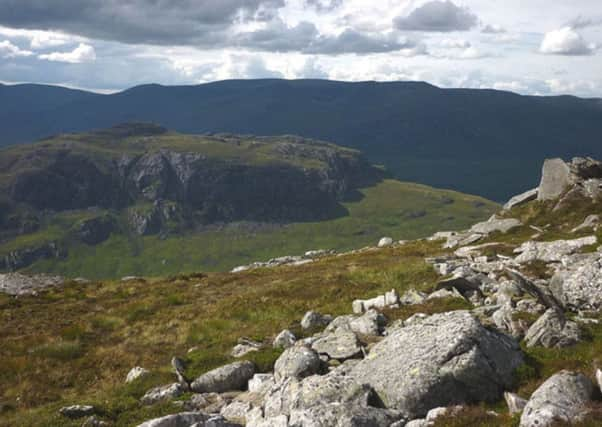
Walk of the week: Creag Pitridh and Geal Charn


The modest 924m/3031ft Creag Pitridh, spelled Peathraich in the 1891 Tables and on early maps, could mean Petrie’s Crag. Was he perhaps a soldier, for Sgurr an t-Saighdeir lies to the south-west? It is a descent of only 105m (but far from being the smallest Munro drop) to a 819m col that separates the hill from Geal Charn. Despite its pleasing conical shape as seen from the Laggan road, Creag Pitridh feels more like a subsidiary Top of Geal Charn rather than a Munro.
1049m/3442ft Geal Charn was originally called Mullach Coire an Iubhair – high ground above the corrie of the yew tree – presumably referring to the northern craggy corrie; a more interesting and possibly more accurate name. It was renamed in 1981, surprisingly late as the 1920s one-inch maps clearly show Geal Charn as the summit and make no mention of that earlier name.
Advertisement
Hide AdI prefer, albeit, longer approaches to both hills from Dalwhinnie, rather than from Lagganside, but then there is the Allt Cam to be forded. Boots off, or splashing over, is best kept for summer and not for March.
The Route
Park by the A86 at map ref 433831. Cross the concrete bridge over the River Spean for the broad-at-first track that eases the 3-mile rise to the south-west end of Lochan na h-Earba. It is possible to cycle, with a freewheeling return, but the 7-hour time assumes walking.
The track alongside the lochan, and then a stalkers’ path, give an easy approach to Creag Pitridh via the short north-east ridge, an area seldom frequented by hillwalkers. However, use the stalkers’ path that climbs ESE on the north side of the Allt Coire Pitridh. Leave the path before it crosses the burn and traverse rough, often wet terrain, eased by curving to higher ground below Sgurr an t-Saighdeir. Eventually reach the rough summit cone, a superb viewpoint.
Now for Geal Charn, a hill completely encircled by stalkers’ paths. Creag Pitridh’s craggy eastern escarpment may be surprisingly difficult on a wet, misty, or icy day. Descend south at first, then south-east, to the col, and climb to cross a stalkers’ path, completely snow-covered on my day.
Head east, then north-east, over gently sloping stony terrain to reach a minor bump that may cause confusion on a misty day – a climb that always takes longer than anticipated. The actual summit consists of a circular trig point tucked in beside a very large cairn.
It was only on approaching the summit of Geal Charn that I caught up with two other walkers, Lynsey and Ruairi Fitzpatrick, and their two dogs. Lynsey explained that she (and her labrador Rabbie) have committed to climb all the Munros to raise sponsorship for the soldiers’ charity, Help for Heroes. They started the challenge in June 2012, aiming to complete by Christmas Day 2014. Visit www.bmycharity.com/LynseyFitzpatrick or view their progress at www.facebook.com/Lynseyandrabbie.
Advertisement
Hide AdThe south-west descent may be tricky in bad weather. Take an accurate bearing, heading for the large gap between the major crags overlooking Loch a’Bhealaich Leamhain and the less serious crags to the west. Reach the path on the east side of the col, circa map ref 490805, follow it south to the second junction, map ref 489800, then descend westwards to cross the Allt Coire Pitridh. (Cutting off the path dogleg means a traverse over rough terrain.)
Map Ordnance Survey map 42, Glen Garry & Loch Rannoch
Distance 14 miles
Height 1,000m
Terrain Track and path to grassy hillside
Start point Parking strip on south side of A86, map ref 433831
Time 7 hours
Nearest village Roybridge
Refreshment spot Stronlossit Hotel, Roybridge