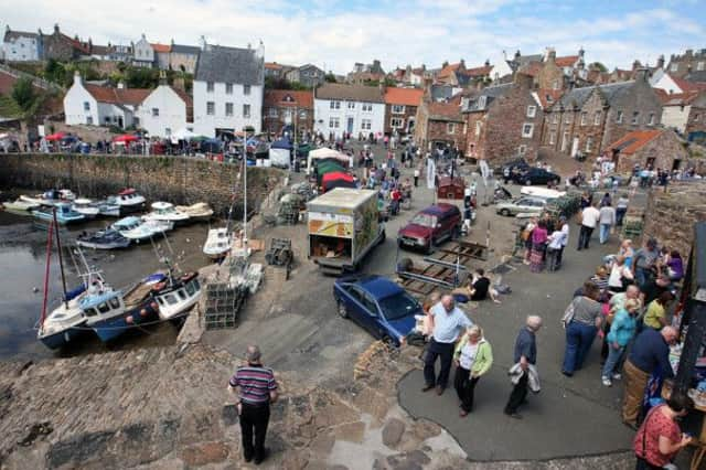
Walk of the Week: Crail to Cambo Sands


In leaving Crail, the last of the East Neuk villages, there is a sense of remoteness in traversing the easterly bulge of Fife, heading for Fife Ness. This sandstone headland, the most easterly point of Fife, seems to challenge the might of the North Sea. With an almost imperceptible change of direction at first, the terrain gradually becomes more gentle passing by Cambo Sands on the way to St Andrews. There are no villages along the way though there are some links golf courses to be skirted. (To avoid disturbance to players and for your own safety walkers should keep to the path.)
A pre-placed car at Cambo Sands car park, by Kingsbarns, meant that our 6-mile linear walk was not too far in the adverse conditions. A narrow lane, Back Stile, leads from the car park to the village and the A917. The regular St Andrews/Crail bus service passes by Kingsbarns – phone Traveline 0871 200 2233 – and more information is available on www.fife coastalpath.co.uk
Advertisement
Hide AdThe East Neuk has a long history of links with the Netherlands – for example Crail Harbour and church were built as a joint venture with the Dutch. Salt and fish were being exported from Crail some 1100 years ago. Crail once had a castle, the occasional residence of King David I in the 12th century.
the route
Pass a 16th century doocot, looked after by the Crail Preservation Society, then the FCP signposted way leads through a caravan park that seems to extend forever; not the most exciting start to the walk.
Continue through the narrow strip of the Kilminning Coast Wildlife Reserve that attracts plenty of birdlife. High above, hidden from view, is the former HMS Jackdaw Airfield, a Royal Naval Air Station during the Second World War; the former runway now used for go-karting.
Pass on the water’s edge an entirely natural formation, a large rock known as Kilminning Castle, and so to Fife Ness and the seabird hide, built by kind permission of Crail Golfing Society, the 7th oldest golf club in the world, established 1786. There has been a coastguard station at Fife Ness since at least 1846. Controversially to many, the station was closed in November 2012. Fife Ness harbour is a rare example of a sea beacon construction yard first mentioned in 1537 and where customs and shore dues for Crail were collected.
Continue by Balcomie Links golf course, follow its perimeter, and then by Constantine’s Cave. According to local legend King Constantine was killed in this so-called Black Cave after a battle with the Danes in 874. Popularly ascribed to Danish invaders, hence the name Danes’ Dike, as mapped, is a bank or wall that once cut off the whole promontory of Fife Ness. Later note the sign – please walk on the beach for next half mile, but give time for the high tide to recede. A scrambly diversion higher up is not recommended.
A pleasant stroll leads to Cambo Burn by a lovely wooded strip and Kingsbarns Golf Links, and so to the golden Cambo Sands, backed by extensive sand dunes that stretch for almost 2 miles; a captivating walk made even more delightful when the tide is far out. A short distance from the car park, a line of dressed stone runs down to the sea from the upper shore; all that is left of Kingsbarns harbour built in the 19th century for transporting potatoes and coal.
Advertisement
Hide AdMap Ordnance Survey map 59, St Andrews, Kirkcaldy & Glenrothes
Distance 6 miles
Height Negligible
Terrain Coastal path
Start point Crail harbour
Time 3 hours
Nearest village Crail
Refreshment spot Crail Harbour Gallery and Tearoom