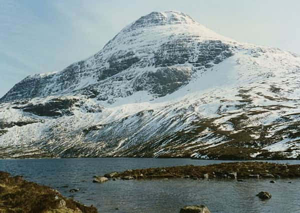
The Walk: Maol Chean-dearg


Both glens offer attractive routes to the 933m/3061ft summit and repeat visits seldom disappoint.
Surrounded by sandstone crags, Maol Chean-dearg gives the impression of a fortress, with few points easily breached; an aspect best appreciated on a northern approach facing the crags above Loch an Eoin. Yet it is one of the few hills to be completely encircled by stalkers’ paths, one of which, leading to the southeast ridge, gives the easiest, hence most popular, approach.
Advertisement
Hide AdThis hill is unlikely to be confused with its similar namesake, Maol Chinn-dearg, a modest summit seen by many as the halfway point in traversing the South Cluanie ridge.
Maol Chean-dearg is one of the best viewpoints in the country. Save it for a good day. On my day the weather forecast indicated low cloud gradually rising to give a 60 per cent chance of cloud-free summits, so I had a leisurely start. Once on the small flat summit area, bereft of vegetation (the name means bald red head) hey ho, the sun broke through.
During the walk I met Jenny McLaren, returning with water samples taken from Loch Coire Fionnaraich. She is employed on behalf of UWMN, the Upland Waters Monitoring Network, whose remit is to track changes in water quality and biodiversity in upland streams and lakes (sic) across the UK, with acid deposition being but one aspect. Only sites in the far north receive nitrogen deposition below the critical road. More information is available from www.awmn.defra.gov.uk.
THE ROUTE
Use the car park by the A890, west of the bridge over the Fionn-abhainn, map ref 956451. Cross the bridge to the track and the start of a right of way to Glen Torridon by the Bealach Ban. After a detour by Coulags Lodge, a stalkers’ path heads north. After 1½ miles, a bridge is reached and the path resumes on the west side, passing Coire Fionnaraich bothy, maintained by the Mountain Bothies Association, and a good resting spot.
The privileged few members of the Elite Bothy Club have T-shirts with a picture of this bothy. The ash tree by the front door is no more but a few new trees have been planted. I hope they won’t be vandalised for firewood.
Pass Clach nan Con-fionn where the hunting dogs of Fingal, father of Ossian, were said to have been tethered. The renovated path soon comes to an end but continues in rough form to the cairned junction, map ref 948490. Turn west, and the path, though badly eroded in places, eases the ascent to Bealach a’Choire Gharbh at a height of 590m. The pass overlooks Loch Coire an Ruadh-staic, which almost fills its corrie on the northern slopes of the superb Corbett.
Advertisement
Hide AdClimb north-west on the initial distinct zigzag scree path. The ground levels off as the path meanders over a stony section to a tiny bump that could conceivably be mistaken for the top on a bad day. I should know. The final 150m over tumbled boulders leads to the broad summit, with the large cairn near the edge of the northern crags. Walk to the edge for one of the best viewpoints in the country.
The safest return is to retrace steps.
Only consider a descent by the east ridge to Loch Coire Fionnaraich on a superb day. The map does not do justice to the rough nature of the ground. Descend a short distance east then south into Coire Garbh to avoid the craggy prow of the east ridge.