Lost Edinburgh: The City Walls
This article contains affiliate links. We may earn a small commission on items purchased through this article, but that does not affect our editorial judgement.


It was known as the King’s Wall and enclosed a small portion of the current city centre, running east from the Castle rock above the Grassmarket towards roughly where Blackfriars Street is today. The King’s Wall, the natural fortifications of the Castle Rock and the Nor’ Loch – an artificial body of water to the north of the town, ensured that Edinburgh was well protected from the threat of invasion on a number of occasions. Remnants of the King’s Wall are thought to stand today in Tweeddale Court between the High Street and the Cowgate.
Flodden Wall
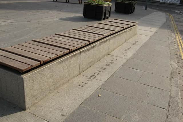
As the town expanded, the King’s Wall became increasingly ineffective as many homes now lay outside of it. Areas such as the Cowgate, which at that time was a fashionable suburb of the town, were dangerously exposed and a new wall was required to replace the ageing and inadequate original structure. This need for better defence was given greater importance following the disastrous Battle of Flodden in 1513 when an estimated 17,000 men led by James IV were slaughtered by the English. The fear of further attack from the Auld Enemy is said to have been the major reason for building Edinburgh’s second official wall: The Flodden Wall. However, there are many who dispute this, claiming that the wall was never up to the task of defending the town against an invading army and was most likely constructed in order to better control trade and act as a deterrent to smugglers.
Ports
Advertisement
Hide AdSeveral ports – large gateways located at each of the major routes into the city allowed people in and out. The street names West Port and Bristo Port are evidence of this today, but the most impressive was undoubtedly the Netherbow. The Netherbow Port was a large fortified gateway constructed around the same time as the rest of the Flodden Wall. It stood on the centre of the High Street at the junction of St Mary’s Street and Jeffrey Street. The Netherbow was eventually demolished in 1764 in order to improve traffic flow in Edinburgh’s Old Town.
Telfer Wall
The final extension of the city walls began in 1620 to enclose 10 acres of land close to modern day Lauriston Place. The new wall was named the Telfer Wall, after its mason John Taillefer.
Removal and remnants
In the late 1700s, work commenced on removal of vast sections of Edinburgh’s ancient town walls which were now considered redundant. Very little survives in 2014 as a result - though most of the wall’s boundary can be easily traced. At the Vennel, Greyfriars Kirkyard and on Lauriston Place, sizeable remains of both the Flodden and Telfer walls are still visible while another well preserved example is located at the corner of Drummond Street and the Pleasance. Archaeologists discovered further remains of the Flodden Wall during a revamp of the Grassmarket in 2008. At the King’s Stables Road end of the Grassmarket, the line of the wall is now marked out in the paving stones.